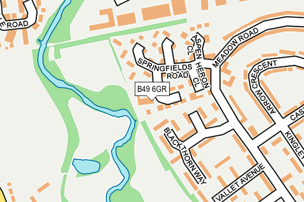
B49 6GR is located in the Alcester East electoral ward, within the local authority district of Stratford-on-Avon and the English Parliamentary constituency of Stratford-on-Avon. The Sub Integrated Care Board (ICB) Location is NHS Coventry and Warwickshire ICB - B2M3M and the police force is Warwickshire. This postcode has been in use since July 2017.


GetTheData
Source: OS OpenMap – Local (Ordnance Survey)
Source: OS VectorMap District (Ordnance Survey)
Licence: Open Government Licence (requires attribution)
| Easting | 409414 |
| Northing | 257760 |
| Latitude | 52.217987 |
| Longitude | -1.863615 |
GetTheData
Source: Open Postcode Geo
Licence: Open Government Licence
| Country | England |
| Postcode District | B49 |
➜ See where B49 is on a map ➜ Where is Alcester? | |
GetTheData
Source: Land Registry Price Paid Data
Licence: Open Government Licence
| Ward | Alcester East |
| Constituency | Stratford-on-avon |
GetTheData
Source: ONS Postcode Database
Licence: Open Government Licence
| St Benedicts Rc School (Grounds) | Alcester | 104m |
| Crooks Lane (Kinwarton Road) | Alcester | 150m |
| St Faiths Road (Hertford Road) | Alcester | 203m |
| Gunnings Road (St Faith's Road) | Alcester | 236m |
| St Faiths Road (Gunnings Road) | Alcester | 238m |
GetTheData
Source: NaPTAN
Licence: Open Government Licence
| Median download speed | 22.4Mbps |
| Average download speed | 37.2Mbps |
| Maximum download speed | 80.00Mbps |
| Median upload speed | 1.3Mbps |
| Average upload speed | 7.7Mbps |
| Maximum upload speed | 20.00Mbps |
GetTheData
Source: Ofcom
Licence: Ofcom Terms of Use (requires attribution)
GetTheData
Source: ONS Postcode Database
Licence: Open Government Licence


➜ Get more ratings from the Food Standards Agency
GetTheData
Source: Food Standards Agency
Licence: FSA terms & conditions
| Last Collection | |||
|---|---|---|---|
| Location | Mon-Fri | Sat | Distance |
| Henley St | 17:30 | 12:00 | 373m |
| Throckmorton Road / Gerard Road | 17:30 | 12:00 | 420m |
| Alcester Post Office | 18:15 | 12:30 | 634m |
GetTheData
Source: Dracos
Licence: Creative Commons Attribution-ShareAlike
The below table lists the International Territorial Level (ITL) codes (formerly Nomenclature of Territorial Units for Statistics (NUTS) codes) and Local Administrative Units (LAU) codes for B49 6GR:
| ITL 1 Code | Name |
|---|---|
| TLG | West Midlands (England) |
| ITL 2 Code | Name |
| TLG1 | Herefordshire, Worcestershire and Warwickshire |
| ITL 3 Code | Name |
| TLG13 | Warwickshire CC |
| LAU 1 Code | Name |
| E07000221 | Stratford-on-Avon |
GetTheData
Source: ONS Postcode Directory
Licence: Open Government Licence
The below table lists the Census Output Area (OA), Lower Layer Super Output Area (LSOA), and Middle Layer Super Output Area (MSOA) for B49 6GR:
| Code | Name | |
|---|---|---|
| OA | E00158959 | |
| LSOA | E01031186 | Stratford-on-Avon 006D |
| MSOA | E02006509 | Stratford-on-Avon 006 |
GetTheData
Source: ONS Postcode Directory
Licence: Open Government Licence
| B49 6PX | Kinwarton Road | 56m |
| B49 6QX | Fairwater Crescent | 133m |
| B49 6PR | Meadow View Close | 138m |
| B49 6QY | Wharrage Road | 139m |
| B49 6AA | The Hopkins Precinct | 144m |
| B49 6QR | Fields Park Drive | 166m |
| B49 6PZ | Ten Acres | 171m |
| B49 6PY | Ten Acres | 186m |
| B49 6QT | Kinwarton Road | 213m |
| B49 6RB | Fairwater Crescent | 236m |
GetTheData
Source: Open Postcode Geo; Land Registry Price Paid Data
Licence: Open Government Licence