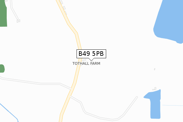
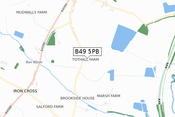
B49 5PB is located in the Salford Priors & Alcester Rural electoral ward, within the local authority district of Stratford-on-Avon and the English Parliamentary constituency of Stratford-on-Avon. The Sub Integrated Care Board (ICB) Location is NHS Coventry and Warwickshire ICB - B2M3M and the police force is Warwickshire. This postcode has been in use since May 2019.


GetTheData
Source: OS Open Zoomstack (Ordnance Survey)
Licence: Open Government Licence (requires attribution)
Attribution: Contains OS data © Crown copyright and database right 2024
Source: Open Postcode Geo
Licence: Open Government Licence (requires attribution)
Attribution: Contains OS data © Crown copyright and database right 2024; Contains Royal Mail data © Royal Mail copyright and database right 2024; Source: Office for National Statistics licensed under the Open Government Licence v.3.0
| Easting | 406947 |
| Northing | 252739 |
| Latitude | 52.172881 |
| Longitude | -1.899827 |
GetTheData
Source: Open Postcode Geo
Licence: Open Government Licence
| Country | England |
| Postcode District | B49 |
➜ See where B49 is on a map | |
GetTheData
Source: Land Registry Price Paid Data
Licence: Open Government Licence
| Ward | Salford Priors & Alcester Rural |
| Constituency | Stratford-on-avon |
GetTheData
Source: ONS Postcode Database
Licence: Open Government Licence
| Church (Tothall Lane) | Dunnington | 826m |
| Church (Tothall Lane) | Dunnington | 834m |
| Reservoir (Broom Lane) | Dunnington | 913m |
| Crossroads (A435) | Dunnington | 1,007m |
| Queens Head (Evesham Road) | Iron Cross | 1,043m |
GetTheData
Source: NaPTAN
Licence: Open Government Licence
GetTheData
Source: ONS Postcode Database
Licence: Open Government Licence


➜ Get more ratings from the Food Standards Agency
GetTheData
Source: Food Standards Agency
Licence: FSA terms & conditions
| Last Collection | |||
|---|---|---|---|
| Location | Mon-Fri | Sat | Distance |
| Irons Cross | 16:30 | 07:45 | 1,054m |
| Salford Priors P.o. | 16:45 | 09:00 | 1,106m |
| Wood Bevington Village | 09:30 | 08:30 | 1,590m |
GetTheData
Source: Dracos
Licence: Creative Commons Attribution-ShareAlike
The below table lists the International Territorial Level (ITL) codes (formerly Nomenclature of Territorial Units for Statistics (NUTS) codes) and Local Administrative Units (LAU) codes for B49 5PB:
| ITL 1 Code | Name |
|---|---|
| TLG | West Midlands (England) |
| ITL 2 Code | Name |
| TLG1 | Herefordshire, Worcestershire and Warwickshire |
| ITL 3 Code | Name |
| TLG13 | Warwickshire CC |
| LAU 1 Code | Name |
| E07000221 | Stratford-on-Avon |
GetTheData
Source: ONS Postcode Directory
Licence: Open Government Licence
The below table lists the Census Output Area (OA), Lower Layer Super Output Area (LSOA), and Middle Layer Super Output Area (MSOA) for B49 5PB:
| Code | Name | |
|---|---|---|
| OA | E00159004 | |
| LSOA | E01031189 | Stratford-on-Avon 012A |
| MSOA | E02006515 | Stratford-on-Avon 012 |
GetTheData
Source: ONS Postcode Directory
Licence: Open Government Licence
| B49 5NY | Conway Croft | 379m |
| B49 5NX | 785m | |
| WR11 8SH | 888m | |
| WR11 8SG | Tothall Lane | 890m |
| WR11 8UZ | Perkins Close | 936m |
| B49 5NT | 948m | |
| WR11 8XN | School Road | 954m |
| WR11 8XX | Park Hall Mews | 976m |
| WR11 8UY | St Matthews Close | 992m |
| B49 5PA | 1032m |
GetTheData
Source: Open Postcode Geo; Land Registry Price Paid Data
Licence: Open Government Licence