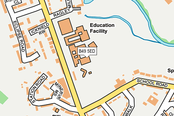
B49 5ED is located in the Alcester West electoral ward, within the local authority district of Stratford-on-Avon and the English Parliamentary constituency of Stratford-on-Avon. The Sub Integrated Care Board (ICB) Location is NHS Coventry and Warwickshire ICB - B2M3M and the police force is Warwickshire. This postcode has been in use since January 1980.


GetTheData
Source: OS OpenMap – Local (Ordnance Survey)
Source: OS VectorMap District (Ordnance Survey)
Licence: Open Government Licence (requires attribution)
| Easting | 408656 |
| Northing | 257782 |
| Latitude | 52.218184 |
| Longitude | -1.874718 |
GetTheData
Source: Open Postcode Geo
Licence: Open Government Licence
| Country | England |
| Postcode District | B49 |
➜ See where B49 is on a map ➜ Where is Alcester? | |
GetTheData
Source: Land Registry Price Paid Data
Licence: Open Government Licence
Elevation or altitude of B49 5ED as distance above sea level:
| Metres | Feet | |
|---|---|---|
| Elevation | 40m | 131ft |
Elevation is measured from the approximate centre of the postcode, to the nearest point on an OS contour line from OS Terrain 50, which has contour spacing of ten vertical metres.
➜ How high above sea level am I? Find the elevation of your current position using your device's GPS.
GetTheData
Source: Open Postcode Elevation
Licence: Open Government Licence
| Ward | Alcester West |
| Constituency | Stratford-on-avon |
GetTheData
Source: ONS Postcode Database
Licence: Open Government Licence
| Alcester Grammar School (Grounds) | Alcester | 51m |
| Grammar School (Birmingham Road) | Alcester | 102m |
| Grammar School (Birmingham Road) | Alcester | 121m |
| Police Station (Priory Road) | Alcester | 437m |
| Police Station (Priory Road) | Alcester | 442m |
GetTheData
Source: NaPTAN
Licence: Open Government Licence
GetTheData
Source: ONS Postcode Database
Licence: Open Government Licence


➜ Get more ratings from the Food Standards Agency
GetTheData
Source: Food Standards Agency
Licence: FSA terms & conditions
| Last Collection | |||
|---|---|---|---|
| Location | Mon-Fri | Sat | Distance |
| Birmingham Road Alcester | 17:30 | 12:00 | 181m |
| The Priory | 17:30 | 12:00 | 281m |
| Henley St | 17:30 | 12:00 | 467m |
GetTheData
Source: Dracos
Licence: Creative Commons Attribution-ShareAlike
The below table lists the International Territorial Level (ITL) codes (formerly Nomenclature of Territorial Units for Statistics (NUTS) codes) and Local Administrative Units (LAU) codes for B49 5ED:
| ITL 1 Code | Name |
|---|---|
| TLG | West Midlands (England) |
| ITL 2 Code | Name |
| TLG1 | Herefordshire, Worcestershire and Warwickshire |
| ITL 3 Code | Name |
| TLG13 | Warwickshire CC |
| LAU 1 Code | Name |
| E07000221 | Stratford-on-Avon |
GetTheData
Source: ONS Postcode Directory
Licence: Open Government Licence
The below table lists the Census Output Area (OA), Lower Layer Super Output Area (LSOA), and Middle Layer Super Output Area (MSOA) for B49 5ED:
| Code | Name | |
|---|---|---|
| OA | E00158951 | |
| LSOA | E01031184 | Stratford-on-Avon 006B |
| MSOA | E02006509 | Stratford-on-Avon 006 |
GetTheData
Source: ONS Postcode Directory
Licence: Open Government Licence
| B49 5ES | Birmingham Road | 93m |
| B49 5DJ | School Road | 128m |
| B49 5EP | Birmingham Road | 134m |
| B49 5EY | Minerva Mews | 172m |
| B49 5DH | School Road | 181m |
| B49 5EL | Allwoods Close | 182m |
| B49 5ET | Station Road | 191m |
| B49 5ER | Railway Mews | 197m |
| B49 5EW | Icknield Row | 217m |
| B49 5EU | Georgian Close | 231m |
GetTheData
Source: Open Postcode Geo; Land Registry Price Paid Data
Licence: Open Government Licence