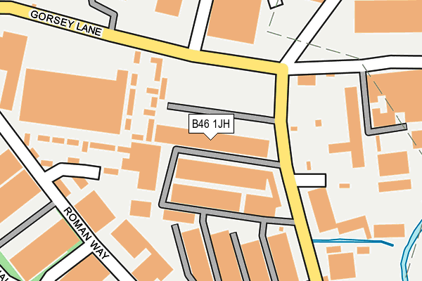
B46 1JH is located in the Coleshill North electoral ward, within the local authority district of North Warwickshire and the English Parliamentary constituency of North Warwickshire. The Sub Integrated Care Board (ICB) Location is NHS Coventry and Warwickshire ICB - B2M3M and the police force is Warwickshire. This postcode has been in use since January 2008.


GetTheData
Source: OS OpenMap – Local (Ordnance Survey)
Source: OS VectorMap District (Ordnance Survey)
Licence: Open Government Licence (requires attribution)
| Easting | 419735 |
| Northing | 290678 |
| Latitude | 52.513636 |
| Longitude | -1.710628 |
GetTheData
Source: Open Postcode Geo
Licence: Open Government Licence
| Country | England |
| Postcode District | B46 |
➜ See where B46 is on a map ➜ Where is Coleshill? | |
GetTheData
Source: Land Registry Price Paid Data
Licence: Open Government Licence
Elevation or altitude of B46 1JH as distance above sea level:
| Metres | Feet | |
|---|---|---|
| Elevation | 80m | 262ft |
Elevation is measured from the approximate centre of the postcode, to the nearest point on an OS contour line from OS Terrain 50, which has contour spacing of ten vertical metres.
➜ How high above sea level am I? Find the elevation of your current position using your device's GPS.
GetTheData
Source: Open Postcode Elevation
Licence: Open Government Licence
| Ward | Coleshill North |
| Constituency | North Warwickshire |
GetTheData
Source: ONS Postcode Database
Licence: Open Government Licence
| Headlam Factory (Gorsey Lane) | Coleshill | 119m |
| Headlam Factory (Gorsey Lane) | Coleshill | 129m |
| Coleshill Parkway (Private Road) | Coleshill | 325m |
| Coleshill Parkway (Private Road) | Coleshill | 325m |
| Coleshill Parkway (Private Road) | Coleshill | 328m |
| Coleshill Parkway Station | 0.4km |
| Water Orton Station | 2.3km |
GetTheData
Source: NaPTAN
Licence: Open Government Licence
GetTheData
Source: ONS Postcode Database
Licence: Open Government Licence

➜ Get more ratings from the Food Standards Agency
GetTheData
Source: Food Standards Agency
Licence: FSA terms & conditions
| Last Collection | |||
|---|---|---|---|
| Location | Mon-Fri | Sat | Distance |
| Gorsey Lane / Station Road | 17:30 | 07:00 | 122m |
| Chattle Hill | 18:30 | 236m | |
| Chattle Hill | 18:30 | 11:00 | 401m |
GetTheData
Source: Dracos
Licence: Creative Commons Attribution-ShareAlike
| Risk of B46 1JH flooding from rivers and sea | Low |
| ➜ B46 1JH flood map | |
GetTheData
Source: Open Flood Risk by Postcode
Licence: Open Government Licence
The below table lists the International Territorial Level (ITL) codes (formerly Nomenclature of Territorial Units for Statistics (NUTS) codes) and Local Administrative Units (LAU) codes for B46 1JH:
| ITL 1 Code | Name |
|---|---|
| TLG | West Midlands (England) |
| ITL 2 Code | Name |
| TLG1 | Herefordshire, Worcestershire and Warwickshire |
| ITL 3 Code | Name |
| TLG13 | Warwickshire CC |
| LAU 1 Code | Name |
| E07000218 | North Warwickshire |
GetTheData
Source: ONS Postcode Directory
Licence: Open Government Licence
The below table lists the Census Output Area (OA), Lower Layer Super Output Area (LSOA), and Middle Layer Super Output Area (MSOA) for B46 1JH:
| Code | Name | |
|---|---|---|
| OA | E00158130 | |
| LSOA | E01031019 | North Warwickshire 006A |
| MSOA | E02006473 | North Warwickshire 006 |
GetTheData
Source: ONS Postcode Directory
Licence: Open Government Licence
| B46 1HQ | Roman Way | 240m |
| B46 1UD | Caesar Way | 356m |
| B46 1UB | Centurion Close | 377m |
| B46 1HJ | Augustus Close | 379m |
| B46 1TX | Constantine Lane | 405m |
| B46 1UF | Brutus Drive | 419m |
| B46 1UE | Temple Way | 420m |
| B46 1HH | Temple Way | 420m |
| B46 1UG | Imperial Rise | 424m |
| B46 1HL | Julius Drive | 451m |
GetTheData
Source: Open Postcode Geo; Land Registry Price Paid Data
Licence: Open Government Licence