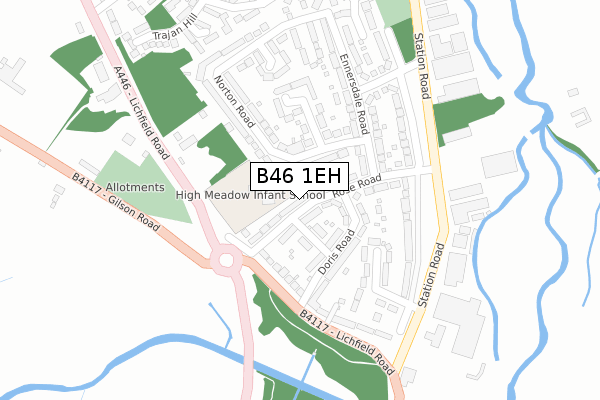
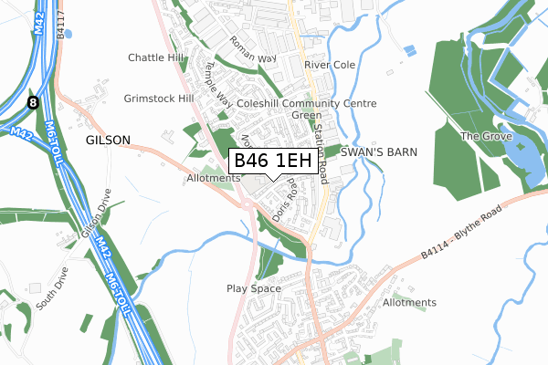
B46 1EH lies on Rose Road in Coleshill, Birmingham. B46 1EH is located in the Coleshill North electoral ward, within the local authority district of North Warwickshire and the English Parliamentary constituency of North Warwickshire. The Sub Integrated Care Board (ICB) Location is NHS Coventry and Warwickshire ICB - B2M3M and the police force is Warwickshire. This postcode has been in use since January 1980.


GetTheData
Source: OS Open Zoomstack (Ordnance Survey)
Licence: Open Government Licence (requires attribution)
Attribution: Contains OS data © Crown copyright and database right 2025
Source: Open Postcode Geo
Licence: Open Government Licence (requires attribution)
Attribution: Contains OS data © Crown copyright and database right 2025; Contains Royal Mail data © Royal Mail copyright and database right 2025; Source: Office for National Statistics licensed under the Open Government Licence v.3.0
| Easting | 419761 |
| Northing | 289867 |
| Latitude | 52.506344 |
| Longitude | -1.710292 |
GetTheData
Source: Open Postcode Geo
Licence: Open Government Licence
| Street | Rose Road |
| Locality | Coleshill |
| Town/City | Birmingham |
| Country | England |
| Postcode District | B46 |
➜ See where B46 is on a map ➜ Where is Coleshill? | |
GetTheData
Source: Land Registry Price Paid Data
Licence: Open Government Licence
Elevation or altitude of B46 1EH as distance above sea level:
| Metres | Feet | |
|---|---|---|
| Elevation | 90m | 295ft |
Elevation is measured from the approximate centre of the postcode, to the nearest point on an OS contour line from OS Terrain 50, which has contour spacing of ten vertical metres.
➜ How high above sea level am I? Find the elevation of your current position using your device's GPS.
GetTheData
Source: Open Postcode Elevation
Licence: Open Government Licence
| Ward | Coleshill North |
| Constituency | North Warwickshire |
GetTheData
Source: ONS Postcode Database
Licence: Open Government Licence
| Ennersdale Close (High Street) | Coleshill | 275m |
| Harvester Pub (Station Road) | Coleshill | 295m |
| Lichfield Road (Station Road) | Coleshill | 301m |
| Ennersdale Close (Station Street) | Coleshill | 311m |
| Temple Way (Station Road) | Coleshill | 408m |
| Coleshill Parkway Station | 1.1km |
| Water Orton Station | 2.6km |
| Marston Green Station | 5.3km |
GetTheData
Source: NaPTAN
Licence: Open Government Licence
| Percentage of properties with Next Generation Access | 100.0% |
| Percentage of properties with Superfast Broadband | 100.0% |
| Percentage of properties with Ultrafast Broadband | 0.0% |
| Percentage of properties with Full Fibre Broadband | 0.0% |
Superfast Broadband is between 30Mbps and 300Mbps
Ultrafast Broadband is > 300Mbps
| Median download speed | 39.8Mbps |
| Average download speed | 43.5Mbps |
| Maximum download speed | 79.16Mbps |
| Median upload speed | 10.0Mbps |
| Average upload speed | 10.1Mbps |
| Maximum upload speed | 20.00Mbps |
| Percentage of properties unable to receive 2Mbps | 0.0% |
| Percentage of properties unable to receive 5Mbps | 0.0% |
| Percentage of properties unable to receive 10Mbps | 0.0% |
| Percentage of properties unable to receive 30Mbps | 0.0% |
GetTheData
Source: Ofcom
Licence: Ofcom Terms of Use (requires attribution)
Estimated total energy consumption in B46 1EH by fuel type, 2015.
| Consumption (kWh) | 512,519 |
|---|---|
| Meter count | 43 |
| Mean (kWh/meter) | 11,919 |
| Median (kWh/meter) | 10,687 |
| Consumption (kWh) | 106,745 |
|---|---|
| Meter count | 37 |
| Mean (kWh/meter) | 2,885 |
| Median (kWh/meter) | 2,777 |
GetTheData
Source: Postcode level gas estimates: 2015 (experimental)
Source: Postcode level electricity estimates: 2015 (experimental)
Licence: Open Government Licence
GetTheData
Source: ONS Postcode Database
Licence: Open Government Licence


➜ Get more ratings from the Food Standards Agency
GetTheData
Source: Food Standards Agency
Licence: FSA terms & conditions
| Last Collection | |||
|---|---|---|---|
| Location | Mon-Fri | Sat | Distance |
| Lichfield Road / Rose Road | 17:30 | 11:30 | 180m |
| Ennersdale Close / Station Road | 17:15 | 11:00 | 267m |
| High Street | 17:30 | 12:00 | 560m |
GetTheData
Source: Dracos
Licence: Creative Commons Attribution-ShareAlike
The below table lists the International Territorial Level (ITL) codes (formerly Nomenclature of Territorial Units for Statistics (NUTS) codes) and Local Administrative Units (LAU) codes for B46 1EH:
| ITL 1 Code | Name |
|---|---|
| TLG | West Midlands (England) |
| ITL 2 Code | Name |
| TLG1 | Herefordshire, Worcestershire and Warwickshire |
| ITL 3 Code | Name |
| TLG13 | Warwickshire CC |
| LAU 1 Code | Name |
| E07000218 | North Warwickshire |
GetTheData
Source: ONS Postcode Directory
Licence: Open Government Licence
The below table lists the Census Output Area (OA), Lower Layer Super Output Area (LSOA), and Middle Layer Super Output Area (MSOA) for B46 1EH:
| Code | Name | |
|---|---|---|
| OA | E00158131 | |
| LSOA | E01031020 | North Warwickshire 006B |
| MSOA | E02006473 | North Warwickshire 006 |
GetTheData
Source: ONS Postcode Directory
Licence: Open Government Licence
| B46 1EL | James Road | 63m |
| B46 1EJ | Doris Road | 89m |
| B46 1EQ | Lichfield Road | 117m |
| B46 1ER | Ennersdale Road | 121m |
| B46 1EN | Rose Road | 141m |
| B46 1EU | Bateman Road | 147m |
| B46 1ET | Norton Road | 154m |
| B46 1ES | Norton Road | 158m |
| B46 1HE | Station Road | 190m |
| B46 1HF | Colebridge Crescent | 197m |
GetTheData
Source: Open Postcode Geo; Land Registry Price Paid Data
Licence: Open Government Licence