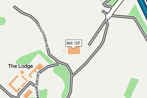
B46 1DF is located in the Coleshill North electoral ward, within the local authority district of North Warwickshire and the English Parliamentary constituency of North Warwickshire. The Sub Integrated Care Board (ICB) Location is NHS Coventry and Warwickshire ICB - B2M3M and the police force is Warwickshire. This postcode has been in use since July 2006.


GetTheData
Source: OS OpenMap – Local (Ordnance Survey)
Source: OS VectorMap District (Ordnance Survey)
Licence: Open Government Licence (requires attribution)
| Easting | 418670 |
| Northing | 289384 |
| Latitude | 52.502041 |
| Longitude | -1.726393 |
GetTheData
Source: Open Postcode Geo
Licence: Open Government Licence
| Country | England |
| Postcode District | B46 |
➜ See where B46 is on a map | |
GetTheData
Source: Land Registry Price Paid Data
Licence: Open Government Licence
Elevation or altitude of B46 1DF as distance above sea level:
| Metres | Feet | |
|---|---|---|
| Elevation | 80m | 262ft |
Elevation is measured from the approximate centre of the postcode, to the nearest point on an OS contour line from OS Terrain 50, which has contour spacing of ten vertical metres.
➜ How high above sea level am I? Find the elevation of your current position using your device's GPS.
GetTheData
Source: Open Postcode Elevation
Licence: Open Government Licence
| Ward | Coleshill North |
| Constituency | North Warwickshire |
GetTheData
Source: ONS Postcode Database
Licence: Open Government Licence
| Gilson Hall (Gilson Road) | Gilson | 834m |
| Orkney Croft (Auckland Dr) | Smith's Wood | 975m |
| Sanda Croft (Auckland Dr) | Bacon's End | 977m |
| Sanda Croft (Auckland Dr) | Bacon's End | 980m |
| Orkney Croft (Auckland Dr) | Smith's Wood | 982m |
| Coleshill Parkway Station | 2km |
| Water Orton Station | 2.2km |
| Marston Green Station | 4.4km |
GetTheData
Source: NaPTAN
Licence: Open Government Licence
GetTheData
Source: ONS Postcode Database
Licence: Open Government Licence


➜ Get more ratings from the Food Standards Agency
GetTheData
Source: Food Standards Agency
Licence: FSA terms & conditions
| Last Collection | |||
|---|---|---|---|
| Location | Mon-Fri | Sat | Distance |
| Gilson Road Gilson (B4117) | 17:15 | 07:00 | 750m |
| Colemeadow Road / Highbrink Road | 17:15 | 07:00 | 987m |
| Auckland Drive/Lundy View | 17:30 | 12:30 | 1,116m |
GetTheData
Source: Dracos
Licence: Creative Commons Attribution-ShareAlike
The below table lists the International Territorial Level (ITL) codes (formerly Nomenclature of Territorial Units for Statistics (NUTS) codes) and Local Administrative Units (LAU) codes for B46 1DF:
| ITL 1 Code | Name |
|---|---|
| TLG | West Midlands (England) |
| ITL 2 Code | Name |
| TLG1 | Herefordshire, Worcestershire and Warwickshire |
| ITL 3 Code | Name |
| TLG13 | Warwickshire CC |
| LAU 1 Code | Name |
| E07000218 | North Warwickshire |
GetTheData
Source: ONS Postcode Directory
Licence: Open Government Licence
The below table lists the Census Output Area (OA), Lower Layer Super Output Area (LSOA), and Middle Layer Super Output Area (MSOA) for B46 1DF:
| Code | Name | |
|---|---|---|
| OA | E00158127 | |
| LSOA | E01031019 | North Warwickshire 006A |
| MSOA | E02006473 | North Warwickshire 006 |
GetTheData
Source: ONS Postcode Directory
Licence: Open Government Licence
| B46 1DN | Gilson Drive | 267m |
| B46 1LN | Gilson Road | 782m |
| B46 1LP | Gilson Road | 813m |
| B46 1LL | Gilson Road | 874m |
| B46 1LJ | Gilson Road | 910m |
| B46 1LQ | Meadowbank Drive | 950m |
| B46 1BP | Duncombe Green | 979m |
| B46 1BL | Colemeadow Road | 992m |
| B36 0NL | Auckland Drive | 993m |
| B46 1LF | Meadowbank Drive | 997m |
GetTheData
Source: Open Postcode Geo; Land Registry Price Paid Data
Licence: Open Government Licence