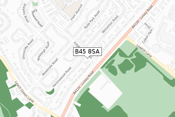
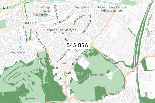
B45 8SA lies on Edgewood Road in Rednal, Birmingham. B45 8SA is located in the Rubery & Rednal electoral ward, within the metropolitan district of Birmingham and the English Parliamentary constituency of Birmingham, Northfield. The Sub Integrated Care Board (ICB) Location is NHS Birmingham and Solihull ICB - 15E and the police force is West Midlands. This postcode has been in use since January 1980.


GetTheData
Source: OS Open Zoomstack (Ordnance Survey)
Licence: Open Government Licence (requires attribution)
Attribution: Contains OS data © Crown copyright and database right 2024
Source: Open Postcode Geo
Licence: Open Government Licence (requires attribution)
Attribution: Contains OS data © Crown copyright and database right 2024; Contains Royal Mail data © Royal Mail copyright and database right 2024; Source: Office for National Statistics licensed under the Open Government Licence v.3.0
| Easting | 400133 |
| Northing | 276698 |
| Latitude | 52.388309 |
| Longitude | -1.999471 |
GetTheData
Source: Open Postcode Geo
Licence: Open Government Licence
| Street | Edgewood Road |
| Locality | Rednal |
| Town/City | Birmingham |
| Country | England |
| Postcode District | B45 |
➜ See where B45 is on a map ➜ Where is Birmingham? | |
GetTheData
Source: Land Registry Price Paid Data
Licence: Open Government Licence
Elevation or altitude of B45 8SA as distance above sea level:
| Metres | Feet | |
|---|---|---|
| Elevation | 190m | 623ft |
Elevation is measured from the approximate centre of the postcode, to the nearest point on an OS contour line from OS Terrain 50, which has contour spacing of ten vertical metres.
➜ How high above sea level am I? Find the elevation of your current position using your device's GPS.
GetTheData
Source: Open Postcode Elevation
Licence: Open Government Licence
| Ward | Rubery & Rednal |
| Constituency | Birmingham, Northfield |
GetTheData
Source: ONS Postcode Database
Licence: Open Government Licence
| Edgewood Rd (Lickey Rd) | Rednal | 75m |
| Edgewood Rd (Lickey Rd) | Rednal | 87m |
| Low Hill Lane (Lickey Rd) | Rednal | 279m |
| Low Hill Lane (Lickey Rd) | Rednal | 296m |
| Leach Green Lane (Lickey Rd) | Rednal | 324m |
| Longbridge Station | 1.5km |
| Barnt Green Station | 3.1km |
| Northfield Station | 3.2km |
GetTheData
Source: NaPTAN
Licence: Open Government Licence
| Percentage of properties with Next Generation Access | 100.0% |
| Percentage of properties with Superfast Broadband | 100.0% |
| Percentage of properties with Ultrafast Broadband | 0.0% |
| Percentage of properties with Full Fibre Broadband | 0.0% |
Superfast Broadband is between 30Mbps and 300Mbps
Ultrafast Broadband is > 300Mbps
| Percentage of properties unable to receive 2Mbps | 0.0% |
| Percentage of properties unable to receive 5Mbps | 0.0% |
| Percentage of properties unable to receive 10Mbps | 0.0% |
| Percentage of properties unable to receive 30Mbps | 0.0% |
GetTheData
Source: Ofcom
Licence: Ofcom Terms of Use (requires attribution)
GetTheData
Source: ONS Postcode Database
Licence: Open Government Licence


➜ Get more ratings from the Food Standards Agency
GetTheData
Source: Food Standards Agency
Licence: FSA terms & conditions
| Last Collection | |||
|---|---|---|---|
| Location | Mon-Fri | Sat | Distance |
| Edgewood Road / Manor Road | 17:15 | 11:30 | 41m |
| Himley Grove / Ormscliffe Road | 17:30 | 11:30 | 354m |
| Creswick Grove / Ryde Park Road | 17:15 | 11:30 | 374m |
GetTheData
Source: Dracos
Licence: Creative Commons Attribution-ShareAlike
The below table lists the International Territorial Level (ITL) codes (formerly Nomenclature of Territorial Units for Statistics (NUTS) codes) and Local Administrative Units (LAU) codes for B45 8SA:
| ITL 1 Code | Name |
|---|---|
| TLG | West Midlands (England) |
| ITL 2 Code | Name |
| TLG3 | West Midlands |
| ITL 3 Code | Name |
| TLG31 | Birmingham |
| LAU 1 Code | Name |
| E08000025 | Birmingham |
GetTheData
Source: ONS Postcode Directory
Licence: Open Government Licence
The below table lists the Census Output Area (OA), Lower Layer Super Output Area (LSOA), and Middle Layer Super Output Area (MSOA) for B45 8SA:
| Code | Name | |
|---|---|---|
| OA | E00046479 | |
| LSOA | E01009163 | Birmingham 129B |
| MSOA | E02001955 | Birmingham 129 |
GetTheData
Source: ONS Postcode Directory
Licence: Open Government Licence
| B45 8SB | Edgewood Road | 96m |
| B45 8RY | Lickey Road | 99m |
| B45 8TF | Lickey Road | 126m |
| B45 8EA | Meadvale Road | 172m |
| B45 8SD | Edgewood Road | 176m |
| B45 8QS | Heronswood Road | 178m |
| B45 8QT | Heronswood Road | 192m |
| B45 8SE | Edgewood Road | 206m |
| B45 8RL | Wolverton Road | 210m |
| B45 8RJ | Ryde Park Road | 219m |
GetTheData
Source: Open Postcode Geo; Land Registry Price Paid Data
Licence: Open Government Licence