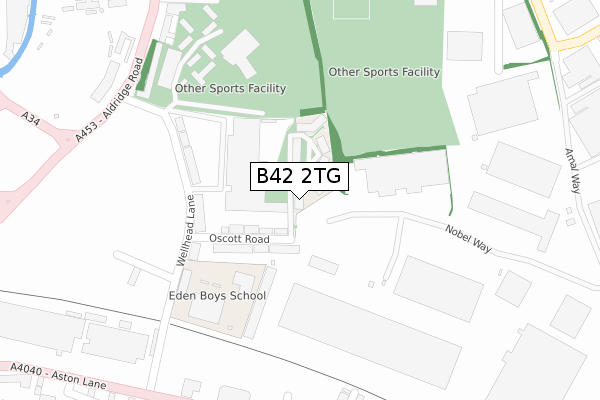
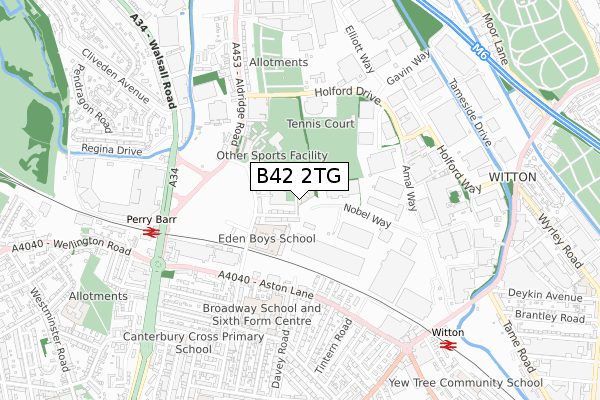
B42 2TG is located in the Perry Barr electoral ward, within the metropolitan district of Birmingham and the English Parliamentary constituency of Birmingham, Perry Barr. The Sub Integrated Care Board (ICB) Location is NHS Birmingham and Solihull ICB - 15E and the police force is West Midlands. This postcode has been in use since February 2020.


GetTheData
Source: OS Open Zoomstack (Ordnance Survey)
Licence: Open Government Licence (requires attribution)
Attribution: Contains OS data © Crown copyright and database right 2025
Source: Open Postcode Geo
Licence: Open Government Licence (requires attribution)
Attribution: Contains OS data © Crown copyright and database right 2025; Contains Royal Mail data © Royal Mail copyright and database right 2025; Source: Office for National Statistics licensed under the Open Government Licence v.3.0
| Easting | 407398 |
| Northing | 291140 |
| Latitude | 52.518109 |
| Longitude | -1.892402 |
GetTheData
Source: Open Postcode Geo
Licence: Open Government Licence
| Country | England |
| Postcode District | B42 |
➜ See where B42 is on a map ➜ Where is Birmingham? | |
GetTheData
Source: Land Registry Price Paid Data
Licence: Open Government Licence
| Ward | Perry Barr |
| Constituency | Birmingham, Perry Barr |
GetTheData
Source: ONS Postcode Database
Licence: Open Government Licence
| Wellhead Lane (Aldridge Rd) | Birmingham City University | 366m |
| Wellhead Lane (Aldridge Rd) | Birmingham City University | 396m |
| Wellhead Lane (Aldridge Rd) | Birmingham City University | 403m |
| Holford Drive (Aldridge Rd) | Birmingham City University | 422m |
| Holford Drive (Aldridge Rd) | Birmingham City University | 429m |
| Perry Barr Station | 0.7km |
| Witton (West Midlands) Station | 0.8km |
| Aston Station | 2.1km |
GetTheData
Source: NaPTAN
Licence: Open Government Licence
GetTheData
Source: ONS Postcode Database
Licence: Open Government Licence


➜ Get more ratings from the Food Standards Agency
GetTheData
Source: Food Standards Agency
Licence: FSA terms & conditions
| Last Collection | |||
|---|---|---|---|
| Location | Mon-Fri | Sat | Distance |
| Oscott Road/Wellhead Road | 17:30 | 12:30 | 243m |
| Aston Lane / Davey Road | 17:45 | 12:30 | 443m |
| Dunsink Road / Aston Lane | 17:30 | 12:30 | 705m |
GetTheData
Source: Dracos
Licence: Creative Commons Attribution-ShareAlike
The below table lists the International Territorial Level (ITL) codes (formerly Nomenclature of Territorial Units for Statistics (NUTS) codes) and Local Administrative Units (LAU) codes for B42 2TG:
| ITL 1 Code | Name |
|---|---|
| TLG | West Midlands (England) |
| ITL 2 Code | Name |
| TLG3 | West Midlands |
| ITL 3 Code | Name |
| TLG31 | Birmingham |
| LAU 1 Code | Name |
| E08000025 | Birmingham |
GetTheData
Source: ONS Postcode Directory
Licence: Open Government Licence
The below table lists the Census Output Area (OA), Lower Layer Super Output Area (LSOA), and Middle Layer Super Output Area (MSOA) for B42 2TG:
| Code | Name | |
|---|---|---|
| OA | E00175787 | |
| LSOA | E01009239 | Birmingham 033F |
| MSOA | E02001859 | Birmingham 033 |
GetTheData
Source: ONS Postcode Directory
Licence: Open Government Licence
| B42 2TA | Oscott Road | 177m |
| B42 2SY | Wellhead Lane | 249m |
| B42 2TU | Holford Drive | 332m |
| B42 2TP | Aldridge Road | 343m |
| B20 3HX | North Road | 400m |
| B6 7BB | Pavilion Drive | 404m |
| B20 3BW | Aston Lane | 414m |
| B20 3HU | London Road | 435m |
| B20 3HY | Aston Lane | 451m |
| B20 3HA | Aston Lane | 465m |
GetTheData
Source: Open Postcode Geo; Land Registry Price Paid Data
Licence: Open Government Licence