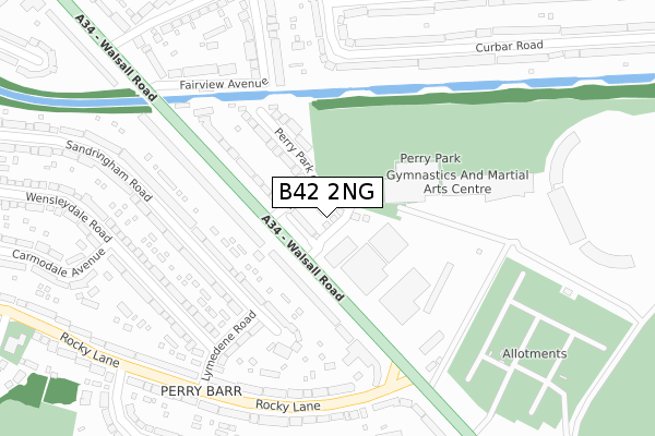
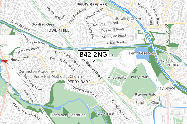
B42 2NG is located in the Perry Barr electoral ward, within the metropolitan district of Birmingham and the English Parliamentary constituency of Birmingham, Perry Barr. The Sub Integrated Care Board (ICB) Location is NHS Birmingham and Solihull ICB - 15E and the police force is West Midlands. This postcode has been in use since February 2019.


GetTheData
Source: OS Open Zoomstack (Ordnance Survey)
Licence: Open Government Licence (requires attribution)
Attribution: Contains OS data © Crown copyright and database right 2025
Source: Open Postcode Geo
Licence: Open Government Licence (requires attribution)
Attribution: Contains OS data © Crown copyright and database right 2025; Contains Royal Mail data © Royal Mail copyright and database right 2025; Source: Office for National Statistics licensed under the Open Government Licence v.3.0
| Easting | 406098 |
| Northing | 292555 |
| Latitude | 52.530846 |
| Longitude | -1.911534 |
GetTheData
Source: Open Postcode Geo
Licence: Open Government Licence
| Country | England |
| Postcode District | B42 |
➜ See where B42 is on a map ➜ Where is Birmingham? | |
GetTheData
Source: Land Registry Price Paid Data
Licence: Open Government Licence
| Ward | Perry Barr |
| Constituency | Birmingham, Perry Barr |
GetTheData
Source: ONS Postcode Database
Licence: Open Government Licence
8, MARATHON POINT, BIRMINGHAM, B42 2NG 2022 30 JUN £267,000 |
14, MARATHON POINT, BIRMINGHAM, B42 2NG 2020 9 SEP £325,000 |
12, MARATHON POINT, BIRMINGHAM, B42 2NG 2020 13 MAR £275,000 |
10, MARATHON POINT, BIRMINGHAM, B42 2NG 2020 21 FEB £250,000 |
6, MARATHON POINT, BIRMINGHAM, B42 2NG 2019 22 NOV £295,000 |
25, MARATHON POINT, BIRMINGHAM, B42 2NG 2019 30 MAY £245,995 |
24, MARATHON POINT, BIRMINGHAM, B42 2NG 2019 17 MAY £309,995 |
27, MARATHON POINT, BIRMINGHAM, B42 2NG 2019 30 APR £245,995 |
GetTheData
Source: HM Land Registry Price Paid Data
Licence: Contains HM Land Registry data © Crown copyright and database right 2025. This data is licensed under the Open Government Licence v3.0.
| Perry Park Crescent (Walsall Rd) | Alexander Stadium | 49m |
| Perry Park Crescent (Walsall Rd) | Alexander Stadium | 84m |
| Rocky Lane (Walsall Rd) | Alexander Stadium | 158m |
| Rocky Lane (Walsall Rd) | Alexander Stadium | 200m |
| Police Station (Rocky Lane) | Alexander Stadium | 269m |
| Hamstead (Birmingham) Station | 1.2km |
| Perry Barr Station | 1.7km |
| Witton (West Midlands) Station | 2.8km |
GetTheData
Source: NaPTAN
Licence: Open Government Licence
| Percentage of properties with Next Generation Access | 0.0% |
| Percentage of properties with Superfast Broadband | 0.0% |
| Percentage of properties with Ultrafast Broadband | 0.0% |
| Percentage of properties with Full Fibre Broadband | 0.0% |
Superfast Broadband is between 30Mbps and 300Mbps
Ultrafast Broadband is > 300Mbps
| Percentage of properties unable to receive 2Mbps | 0.0% |
| Percentage of properties unable to receive 5Mbps | 20.0% |
| Percentage of properties unable to receive 10Mbps | 86.7% |
| Percentage of properties unable to receive 30Mbps | 100.0% |
GetTheData
Source: Ofcom
Licence: Ofcom Terms of Use (requires attribution)
GetTheData
Source: ONS Postcode Database
Licence: Open Government Licence


➜ Get more ratings from the Food Standards Agency
GetTheData
Source: Food Standards Agency
Licence: FSA terms & conditions
| Last Collection | |||
|---|---|---|---|
| Location | Mon-Fri | Sat | Distance |
| Walsall Road / Rocky Lane | 17:45 | 12:30 | 258m |
| Walsall Road / Fairview Avenue | 17:30 | 12:30 | 344m |
| Derrydown Road / Rocky Lane | 17:45 | 12:30 | 412m |
GetTheData
Source: Dracos
Licence: Creative Commons Attribution-ShareAlike
The below table lists the International Territorial Level (ITL) codes (formerly Nomenclature of Territorial Units for Statistics (NUTS) codes) and Local Administrative Units (LAU) codes for B42 2NG:
| ITL 1 Code | Name |
|---|---|
| TLG | West Midlands (England) |
| ITL 2 Code | Name |
| TLG3 | West Midlands |
| ITL 3 Code | Name |
| TLG31 | Birmingham |
| LAU 1 Code | Name |
| E08000025 | Birmingham |
GetTheData
Source: ONS Postcode Directory
Licence: Open Government Licence
The below table lists the Census Output Area (OA), Lower Layer Super Output Area (LSOA), and Middle Layer Super Output Area (MSOA) for B42 2NG:
| Code | Name | |
|---|---|---|
| OA | E00046853 | |
| LSOA | E01009238 | Birmingham 024B |
| MSOA | E02001850 | Birmingham 024 |
GetTheData
Source: ONS Postcode Directory
Licence: Open Government Licence
| B42 2LX | Walsall Road | 124m |
| B42 2LS | Perry Park Crescent | 139m |
| B42 1PG | Sandringham Road | 165m |
| B42 1PE | Nevin Grove | 166m |
| B42 2LT | Walsall Road | 169m |
| B42 1PZ | Sandringham Road | 200m |
| B42 2LU | Walsall Road | 215m |
| B42 1PD | Lymedene Road | 226m |
| B42 1PR | Wensleydale Road | 261m |
| B42 2LZ | Perry Barr Locks | 262m |
GetTheData
Source: Open Postcode Geo; Land Registry Price Paid Data
Licence: Open Government Licence