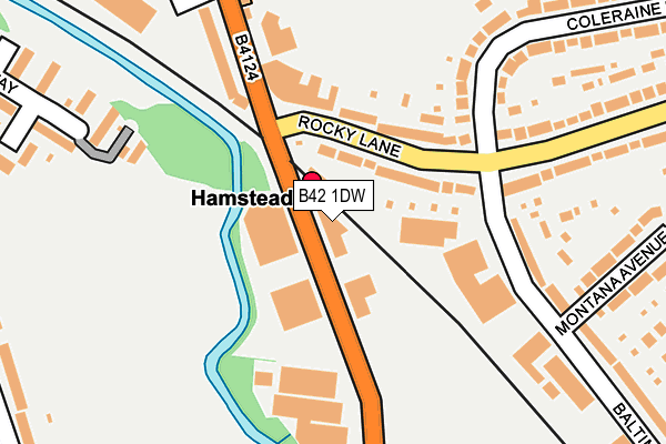
B42 1DW is located in the Handsworth Wood electoral ward, within the metropolitan district of Birmingham and the English Parliamentary constituency of Birmingham, Perry Barr. The Sub Integrated Care Board (ICB) Location is NHS Birmingham and Solihull ICB - 15E and the police force is West Midlands. This postcode has been in use since March 2017.


GetTheData
Source: OS OpenMap – Local (Ordnance Survey)
Source: OS VectorMap District (Ordnance Survey)
Licence: Open Government Licence (requires attribution)
| Easting | 404935 |
| Northing | 292540 |
| Latitude | 52.530722 |
| Longitude | -1.928678 |
GetTheData
Source: Open Postcode Geo
Licence: Open Government Licence
| Country | England |
| Postcode District | B42 |
➜ See where B42 is on a map ➜ Where is Birmingham? | |
GetTheData
Source: Land Registry Price Paid Data
Licence: Open Government Licence
| Ward | Handsworth Wood |
| Constituency | Birmingham, Perry Barr |
GetTheData
Source: ONS Postcode Database
Licence: Open Government Licence
| Austin Way (Old Walsall Rd) | Hamstead | 109m |
| Austin Way (Old Walsall Rd) | Hamstead | 135m |
| Hamstead Railway Station (Old Walsall Rd) | Hamstead | 148m |
| Hamstead Railway Station (Old Walsall Rd) | Hamstead | 180m |
| Hamstead Village (Hamstead Rd) | Gorse Farm | 332m |
| Hamstead (Birmingham) Station | 0km |
| Perry Barr Station | 2.4km |
| Witton (West Midlands) Station | 3.6km |
GetTheData
Source: NaPTAN
Licence: Open Government Licence
| Percentage of properties with Next Generation Access | 100.0% |
| Percentage of properties with Superfast Broadband | 100.0% |
| Percentage of properties with Ultrafast Broadband | 100.0% |
| Percentage of properties with Full Fibre Broadband | 0.0% |
Superfast Broadband is between 30Mbps and 300Mbps
Ultrafast Broadband is > 300Mbps
| Percentage of properties unable to receive 2Mbps | 0.0% |
| Percentage of properties unable to receive 5Mbps | 0.0% |
| Percentage of properties unable to receive 10Mbps | 0.0% |
| Percentage of properties unable to receive 30Mbps | 0.0% |
GetTheData
Source: Ofcom
Licence: Ofcom Terms of Use (requires attribution)
GetTheData
Source: ONS Postcode Database
Licence: Open Government Licence

➜ Get more ratings from the Food Standards Agency
GetTheData
Source: Food Standards Agency
Licence: FSA terms & conditions
| Last Collection | |||
|---|---|---|---|
| Location | Mon-Fri | Sat | Distance |
| Hamstead Post Office | 17:45 | 12:30 | 220m |
| Dorrington Road / Rocky Lane | 17:45 | 12:30 | 431m |
| Kingsdown Avenue / Hillside Dr | 16:30 | 12:30 | 440m |
GetTheData
Source: Dracos
Licence: Creative Commons Attribution-ShareAlike
| Risk of B42 1DW flooding from rivers and sea | Medium |
| ➜ B42 1DW flood map | |
GetTheData
Source: Open Flood Risk by Postcode
Licence: Open Government Licence
The below table lists the International Territorial Level (ITL) codes (formerly Nomenclature of Territorial Units for Statistics (NUTS) codes) and Local Administrative Units (LAU) codes for B42 1DW:
| ITL 1 Code | Name |
|---|---|
| TLG | West Midlands (England) |
| ITL 2 Code | Name |
| TLG3 | West Midlands |
| ITL 3 Code | Name |
| TLG31 | Birmingham |
| LAU 1 Code | Name |
| E08000025 | Birmingham |
GetTheData
Source: ONS Postcode Directory
Licence: Open Government Licence
The below table lists the Census Output Area (OA), Lower Layer Super Output Area (LSOA), and Middle Layer Super Output Area (MSOA) for B42 1DW:
| Code | Name | |
|---|---|---|
| OA | E00046990 | |
| LSOA | E01009278 | Birmingham 133D |
| MSOA | E02006809 | Birmingham 133 |
GetTheData
Source: ONS Postcode Directory
Licence: Open Government Licence
| B42 1NH | Rocky Lane | 71m |
| B42 1NL | Rocky Lane | 99m |
| B42 1NP | Old Walsall Road | 153m |
| B42 1QW | Baltimore Road | 187m |
| B42 1NR | Railway Terrace | 230m |
| B42 1LN | Coleraine Road | 252m |
| B42 1LL | Coleraine Road | 255m |
| B42 1QP | Montana Avenue | 267m |
| B42 1NQ | Rocky Lane | 278m |
| B20 1EQ | Greenway | 289m |
GetTheData
Source: Open Postcode Geo; Land Registry Price Paid Data
Licence: Open Government Licence