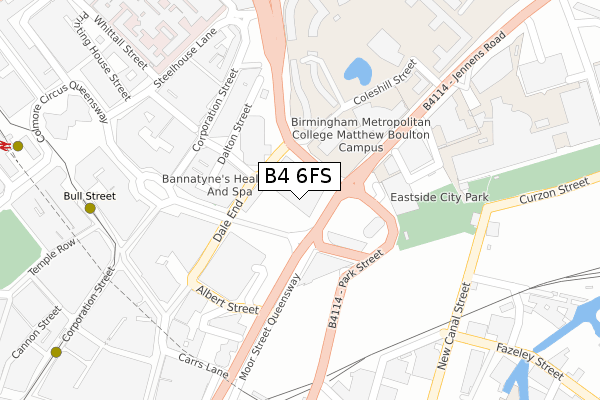
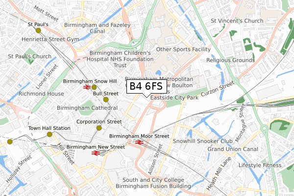
B4 6FS is located in the Ladywood electoral ward, within the metropolitan district of Birmingham and the English Parliamentary constituency of Birmingham, Ladywood. The Sub Integrated Care Board (ICB) Location is NHS Birmingham and Solihull ICB - 15E and the police force is West Midlands. This postcode has been in use since March 2019.


GetTheData
Source: OS Open Zoomstack (Ordnance Survey)
Licence: Open Government Licence (requires attribution)
Attribution: Contains OS data © Crown copyright and database right 2025
Source: Open Postcode Geo
Licence: Open Government Licence (requires attribution)
Attribution: Contains OS data © Crown copyright and database right 2025; Contains Royal Mail data © Royal Mail copyright and database right 2025; Source: Office for National Statistics licensed under the Open Government Licence v.3.0
| Easting | 407490 |
| Northing | 287126 |
| Latitude | 52.482022 |
| Longitude | -1.891135 |
GetTheData
Source: Open Postcode Geo
Licence: Open Government Licence
| Country | England |
| Postcode District | B4 |
➜ See where B4 is on a map ➜ Where is Birmingham? | |
GetTheData
Source: Land Registry Price Paid Data
Licence: Open Government Licence
| Ward | Ladywood |
| Constituency | Birmingham, Ladywood |
GetTheData
Source: ONS Postcode Database
Licence: Open Government Licence
| Bus Mall (The Priory Queensway) | Birmingham | 64m |
| Bus Mall (The Priory Queensway) | Birmingham | 91m |
| Bus Mall (The Priory Queensway) | Birmingham | 106m |
| Albert St (Moor St Queensway) | Birmingham | 109m |
| Albert St (Moor St Queensway) | Birmingham | 111m |
| Bull Street (Midland Metro Stop) (Bull Street) | Birmingham | 351m |
| Corporation Street (Midland Metro Stop) (Corporation Street) | Birmingham | 476m |
| Snow Hill (Midland Metro Stop) (Colmore Row) | Birmingham | 572m |
| Grand Central New Street (Midland Metro Stop) (Stephenson Street) | Birmingham | 671m |
| St Paul's (Midland Metro Stop) (Livery Street) | Jewellery Quarter | 1,011m |
| Birmingham Moor Street Station | 0.3km |
| Birmingham Snow Hill Station | 0.6km |
| Birmingham New Street Station | 0.8km |
GetTheData
Source: NaPTAN
Licence: Open Government Licence
| Percentage of properties with Next Generation Access | 0.0% |
| Percentage of properties with Superfast Broadband | 0.0% |
| Percentage of properties with Ultrafast Broadband | 0.0% |
| Percentage of properties with Full Fibre Broadband | 0.0% |
Superfast Broadband is between 30Mbps and 300Mbps
Ultrafast Broadband is > 300Mbps
| Percentage of properties unable to receive 2Mbps | 0.0% |
| Percentage of properties unable to receive 5Mbps | 0.0% |
| Percentage of properties unable to receive 10Mbps | 0.0% |
| Percentage of properties unable to receive 30Mbps | 100.0% |
GetTheData
Source: Ofcom
Licence: Ofcom Terms of Use (requires attribution)
GetTheData
Source: ONS Postcode Database
Licence: Open Government Licence


➜ Get more ratings from the Food Standards Agency
GetTheData
Source: Food Standards Agency
Licence: FSA terms & conditions
| Last Collection | |||
|---|---|---|---|
| Location | Mon-Fri | Sat | Distance |
| Corporation St Post Office | 18:30 | 12:30 | 221m |
| Victoria Law Courts | 19:00 | 12:30 | 226m |
| High St(B) | 18:30 | 12:30 | 302m |
GetTheData
Source: Dracos
Licence: Creative Commons Attribution-ShareAlike
The below table lists the International Territorial Level (ITL) codes (formerly Nomenclature of Territorial Units for Statistics (NUTS) codes) and Local Administrative Units (LAU) codes for B4 6FS:
| ITL 1 Code | Name |
|---|---|
| TLG | West Midlands (England) |
| ITL 2 Code | Name |
| TLG3 | West Midlands |
| ITL 3 Code | Name |
| TLG31 | Birmingham |
| LAU 1 Code | Name |
| E08000025 | Birmingham |
GetTheData
Source: ONS Postcode Directory
Licence: Open Government Licence
The below table lists the Census Output Area (OA), Lower Layer Super Output Area (LSOA), and Middle Layer Super Output Area (MSOA) for B4 6FS:
| Code | Name | |
|---|---|---|
| OA | E00175661 | |
| LSOA | E01033617 | Birmingham 050F |
| MSOA | E02001876 | Birmingham 050 |
GetTheData
Source: ONS Postcode Directory
Licence: Open Government Licence
| B5 5JE | Masshouse Plaza | 99m |
| B5 5JF | Masshouse Plaza | 99m |
| B5 5JL | Masshouse Plaza | 131m |
| B5 5JN | Masshouse Plaza | 131m |
| B5 5JP | Masshouse Plaza | 136m |
| B4 7LS | Dale End | 247m |
| B4 7SX | Carrs Lane | 297m |
| B4 6BN | Colmore Circus Queensway | 321m |
| B5 5QS | New Bartholomew Street | 321m |
| B2 4UG | Corporation Street | 348m |
GetTheData
Source: Open Postcode Geo; Land Registry Price Paid Data
Licence: Open Government Licence