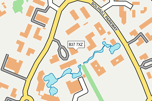
B37 7XZ is located in the Bickenhill electoral ward, within the metropolitan district of Solihull and the English Parliamentary constituency of Meriden. The Sub Integrated Care Board (ICB) Location is NHS Birmingham and Solihull ICB - 15E and the police force is West Midlands. This postcode has been in use since May 2003.


GetTheData
Source: OS OpenMap – Local (Ordnance Survey)
Source: OS VectorMap District (Ordnance Survey)
Licence: Open Government Licence (requires attribution)
| Easting | 419148 |
| Northing | 285632 |
| Latitude | 52.468294 |
| Longitude | -1.719566 |
GetTheData
Source: Open Postcode Geo
Licence: Open Government Licence
| Country | England |
| Postcode District | B37 |
➜ See where B37 is on a map ➜ Where is Birmingham? | |
GetTheData
Source: Land Registry Price Paid Data
Licence: Open Government Licence
Elevation or altitude of B37 7XZ as distance above sea level:
| Metres | Feet | |
|---|---|---|
| Elevation | 100m | 328ft |
Elevation is measured from the approximate centre of the postcode, to the nearest point on an OS contour line from OS Terrain 50, which has contour spacing of ten vertical metres.
➜ How high above sea level am I? Find the elevation of your current position using your device's GPS.
GetTheData
Source: Open Postcode Elevation
Licence: Open Government Licence
| Ward | Bickenhill |
| Constituency | Meriden |
GetTheData
Source: ONS Postcode Database
Licence: Open Government Licence
| Lakeside (Solihull Parkway) | Birmingham Business Park | 113m |
| Unipart (Solihull Parkway) | Birmingham Business Park | 178m |
| Waterside Centre (Solihull Parkway) | Birmingham Business Park | 209m |
| Overflow Car Park (Solihull Parkway) | Birmingham Business Park | 293m |
| Fujitsu (Solihull Parkway) | Birmingham Business Park | 295m |
| Birmingham International Station | 2km |
| Marston Green Station | 2.5km |
| Hampton-in-Arden Station | 4.6km |
GetTheData
Source: NaPTAN
Licence: Open Government Licence
GetTheData
Source: ONS Postcode Database
Licence: Open Government Licence


➜ Get more ratings from the Food Standards Agency
GetTheData
Source: Food Standards Agency
Licence: FSA terms & conditions
| Last Collection | |||
|---|---|---|---|
| Location | Mon-Fri | Sat | Distance |
| Waterside Centre | 18:30 | 12:00 | 222m |
| Elmdon Trading Estate | 224m | ||
| Bickenhill Road / Blackfirs Lane | 17:15 | 12:00 | 892m |
GetTheData
Source: Dracos
Licence: Creative Commons Attribution-ShareAlike
The below table lists the International Territorial Level (ITL) codes (formerly Nomenclature of Territorial Units for Statistics (NUTS) codes) and Local Administrative Units (LAU) codes for B37 7XZ:
| ITL 1 Code | Name |
|---|---|
| TLG | West Midlands (England) |
| ITL 2 Code | Name |
| TLG3 | West Midlands |
| ITL 3 Code | Name |
| TLG32 | Solihull |
| LAU 1 Code | Name |
| E08000029 | Solihull |
GetTheData
Source: ONS Postcode Directory
Licence: Open Government Licence
The below table lists the Census Output Area (OA), Lower Layer Super Output Area (LSOA), and Middle Layer Super Output Area (MSOA) for B37 7XZ:
| Code | Name | |
|---|---|---|
| OA | E00051124 | |
| LSOA | E01010109 | Solihull 009A |
| MSOA | E02002089 | Solihull 009 |
GetTheData
Source: ONS Postcode Directory
Licence: Open Government Licence
| B37 7YN | Solihull Parkway | 92m |
| B37 7YB | Solihull Parkway | 249m |
| B37 7YE | The Crescent | 296m |
| B37 7WY | Solihull Parkway | 365m |
| B37 7YU | Solihull Parkway | 453m |
| B37 7HY | Coleshill Heath Road | 483m |
| B37 7HU | Coleshill Heath Road | 518m |
| B37 7HX | Coleshill Heath Road | 537m |
| B37 7JA | Coleshill Heath Road | 566m |
| B37 7PE | Whitebeam Road | 587m |
GetTheData
Source: Open Postcode Geo; Land Registry Price Paid Data
Licence: Open Government Licence