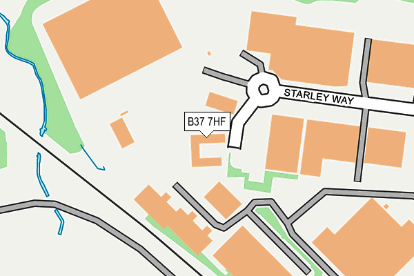
B37 7HF is located in the Bickenhill electoral ward, within the metropolitan district of Solihull and the English Parliamentary constituency of Meriden. The Sub Integrated Care Board (ICB) Location is NHS Birmingham and Solihull ICB - 15E and the police force is West Midlands. This postcode has been in use since December 1995.


GetTheData
Source: OS OpenMap – Local (Ordnance Survey)
Source: OS VectorMap District (Ordnance Survey)
Licence: Open Government Licence (requires attribution)
| Easting | 418103 |
| Northing | 284591 |
| Latitude | 52.458986 |
| Longitude | -1.734997 |
GetTheData
Source: Open Postcode Geo
Licence: Open Government Licence
| Country | England |
| Postcode District | B37 |
➜ See where B37 is on a map ➜ Where is Birmingham? | |
GetTheData
Source: Land Registry Price Paid Data
Licence: Open Government Licence
Elevation or altitude of B37 7HF as distance above sea level:
| Metres | Feet | |
|---|---|---|
| Elevation | 100m | 328ft |
Elevation is measured from the approximate centre of the postcode, to the nearest point on an OS contour line from OS Terrain 50, which has contour spacing of ten vertical metres.
➜ How high above sea level am I? Find the elevation of your current position using your device's GPS.
GetTheData
Source: Open Postcode Elevation
Licence: Open Government Licence
| Ward | Bickenhill |
| Constituency | Meriden |
GetTheData
Source: ONS Postcode Database
Licence: Open Government Licence
| Bickenhill Lane (Coleshill Heath Rd) | National Exhibition Centre | 423m |
| Bickenhill Lane (Coleshill Heath Rd) | National Exhibition Centre | 437m |
| Elmdon Trading Estate (Bickenhill Lane) | National Exhibition Centre | 466m |
| Cottages (Bickenhill Rd) | National Exhibition Centre | 506m |
| Cottages (Bickenhill Rd) | National Exhibition Centre | 510m |
| Birmingham International Airport (Air-rail Link) | Birmingham Airport | 682m |
| Birmingham Intl Rail Station (Air-rail Link) | Birmingham Airport | 1,121m |
| Birmingham International Station | 1.1km |
| Marston Green Station | 1.7km |
| Hampton-in-Arden Station | 4.1km |
GetTheData
Source: NaPTAN
Licence: Open Government Licence
Estimated total energy consumption in B37 7HF by fuel type, 2015.
| Consumption (kWh) | 83,665 |
|---|---|
| Meter count | 7 |
| Mean (kWh/meter) | 11,952 |
| Median (kWh/meter) | 20 |
GetTheData
Source: Postcode level gas estimates: 2015 (experimental)
Source: Postcode level electricity estimates: 2015 (experimental)
Licence: Open Government Licence
GetTheData
Source: ONS Postcode Database
Licence: Open Government Licence


➜ Get more ratings from the Food Standards Agency
GetTheData
Source: Food Standards Agency
Licence: FSA terms & conditions
| Last Collection | |||
|---|---|---|---|
| Location | Mon-Fri | Sat | Distance |
| Bickenhill Road / Blackfirs Lane | 17:15 | 12:00 | 598m |
| Bham Intl Station | 17:00 | 12:00 | 1,117m |
| Elmdon Trading Estate | 1,252m | ||
GetTheData
Source: Dracos
Licence: Creative Commons Attribution-ShareAlike
The below table lists the International Territorial Level (ITL) codes (formerly Nomenclature of Territorial Units for Statistics (NUTS) codes) and Local Administrative Units (LAU) codes for B37 7HF:
| ITL 1 Code | Name |
|---|---|
| TLG | West Midlands (England) |
| ITL 2 Code | Name |
| TLG3 | West Midlands |
| ITL 3 Code | Name |
| TLG32 | Solihull |
| LAU 1 Code | Name |
| E08000029 | Solihull |
GetTheData
Source: ONS Postcode Directory
Licence: Open Government Licence
The below table lists the Census Output Area (OA), Lower Layer Super Output Area (LSOA), and Middle Layer Super Output Area (MSOA) for B37 7HF:
| Code | Name | |
|---|---|---|
| OA | E00051124 | |
| LSOA | E01010109 | Solihull 009A |
| MSOA | E02002089 | Solihull 009 |
GetTheData
Source: ONS Postcode Directory
Licence: Open Government Licence
| B37 7EU | Bickenhill Road | 380m |
| B37 7DX | Digby Drive | 426m |
| B37 7GY | Farndon Avenue | 466m |
| B37 7FW | Moat House Lane | 494m |
| B37 7NW | The Stables Mews | 509m |
| B37 7EY | Bickenhill Lane | 519m |
| B37 7ER | Bickenhill Road | 578m |
| B37 7DU | Digby Drive | 581m |
| B37 7DT | Elmdon Lane | 600m |
| B37 7FP | Ashfield Lane | 622m |
GetTheData
Source: Open Postcode Geo; Land Registry Price Paid Data
Licence: Open Government Licence