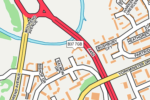
B37 7GB is located in the Chelmsley Wood electoral ward, within the metropolitan district of Solihull and the English Parliamentary constituency of Meriden. The Sub Integrated Care Board (ICB) Location is NHS Birmingham and Solihull ICB - 15E and the police force is West Midlands. This postcode has been in use since April 2017.


GetTheData
Source: OS OpenMap – Local (Ordnance Survey)
Source: OS VectorMap District (Ordnance Survey)
Licence: Open Government Licence (requires attribution)
| Easting | 418308 |
| Northing | 287329 |
| Latitude | 52.483594 |
| Longitude | -1.731831 |
GetTheData
Source: Open Postcode Geo
Licence: Open Government Licence
| Country | England |
| Postcode District | B37 |
➜ See where B37 is on a map ➜ Where is Birmingham? | |
GetTheData
Source: Land Registry Price Paid Data
Licence: Open Government Licence
| Ward | Chelmsley Wood |
| Constituency | Meriden |
GetTheData
Source: ONS Postcode Database
Licence: Open Government Licence
2022 20 APR £300,000 |
2017 31 JUL £266,995 |
2, LAMPREY COURT, BIRMINGHAM, B37 7GB 2017 7 JUL £269,500 |
6, LAMPREY COURT, BIRMINGHAM, B37 7GB 2017 26 MAY £261,995 |
4, LAMPREY COURT, BIRMINGHAM, B37 7GB 2017 26 MAY £249,995 |
8, LAMPREY COURT, BIRMINGHAM, B37 7GB 2017 26 MAY £261,995 |
1, LAMPREY COURT, BIRMINGHAM, B37 7GB 2017 25 APR £249,995 |
GetTheData
Source: HM Land Registry Price Paid Data
Licence: Contains HM Land Registry data © Crown copyright and database right 2025. This data is licensed under the Open Government Licence v3.0.
| Woodlands Way (Yorkminster Dr) | Chelmsley Wood | 203m |
| Richmond Way (Yorkminster Dr) | Chelmsley Wood | 246m |
| Woodlands Way (Yorkminster Dr) | Chelmsley Wood | 278m |
| Richmond Way (Yorkminster Dr) | Chelmsley Wood | 324m |
| Richmond Way (Dunster Rd) | Chelmsley Wood | 347m |
| Marston Green Station | 2.4km |
| Birmingham International Station | 3.7km |
| Lea Hall Station | 3.7km |
GetTheData
Source: NaPTAN
Licence: Open Government Licence
| Percentage of properties with Next Generation Access | 100.0% |
| Percentage of properties with Superfast Broadband | 100.0% |
| Percentage of properties with Ultrafast Broadband | 100.0% |
| Percentage of properties with Full Fibre Broadband | 0.0% |
Superfast Broadband is between 30Mbps and 300Mbps
Ultrafast Broadband is > 300Mbps
| Median download speed | 100.0Mbps |
| Average download speed | 137.7Mbps |
| Maximum download speed | 350.00Mbps |
| Median upload speed | 1.1Mbps |
| Average upload speed | 1.1Mbps |
| Maximum upload speed | 1.19Mbps |
| Percentage of properties unable to receive 2Mbps | 0.0% |
| Percentage of properties unable to receive 5Mbps | 0.0% |
| Percentage of properties unable to receive 10Mbps | 0.0% |
| Percentage of properties unable to receive 30Mbps | 0.0% |
GetTheData
Source: Ofcom
Licence: Ofcom Terms of Use (requires attribution)
GetTheData
Source: ONS Postcode Database
Licence: Open Government Licence


➜ Get more ratings from the Food Standards Agency
GetTheData
Source: Food Standards Agency
Licence: FSA terms & conditions
| Last Collection | |||
|---|---|---|---|
| Location | Mon-Fri | Sat | Distance |
| Lyecroft Avenue / Yorkminster | 17:15 | 12:00 | 784m |
| Barnard Close / Chelmsley Road | 17:15 | 12:00 | 998m |
| Winchester Drive Near Chinches | 17:15 | 12:30 | 1,159m |
GetTheData
Source: Dracos
Licence: Creative Commons Attribution-ShareAlike
The below table lists the International Territorial Level (ITL) codes (formerly Nomenclature of Territorial Units for Statistics (NUTS) codes) and Local Administrative Units (LAU) codes for B37 7GB:
| ITL 1 Code | Name |
|---|---|
| TLG | West Midlands (England) |
| ITL 2 Code | Name |
| TLG3 | West Midlands |
| ITL 3 Code | Name |
| TLG32 | Solihull |
| LAU 1 Code | Name |
| E08000029 | Solihull |
GetTheData
Source: ONS Postcode Directory
Licence: Open Government Licence
The below table lists the Census Output Area (OA), Lower Layer Super Output Area (LSOA), and Middle Layer Super Output Area (MSOA) for B37 7GB:
| Code | Name | |
|---|---|---|
| OA | E00051193 | |
| LSOA | E01010125 | Solihull 006A |
| MSOA | E02002086 | Solihull 006 |
GetTheData
Source: ONS Postcode Directory
Licence: Open Government Licence
| B37 7FU | Pike Drive | 114m |
| B37 7UL | Pike Drive | 119m |
| B37 6RH | Bushbury Croft | 119m |
| B37 7PZ | Bishop Drive | 135m |
| B37 6RJ | Bracken Croft | 160m |
| B37 6UG | Partridge Close | 181m |
| B37 7UH | Roach Close | 240m |
| B37 6UJ | Hawksworth Crescent | 241m |
| B37 6UN | Henbury Drive | 275m |
| B37 6UF | Partridge Close | 275m |
GetTheData
Source: Open Postcode Geo; Land Registry Price Paid Data
Licence: Open Government Licence