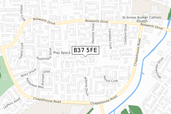
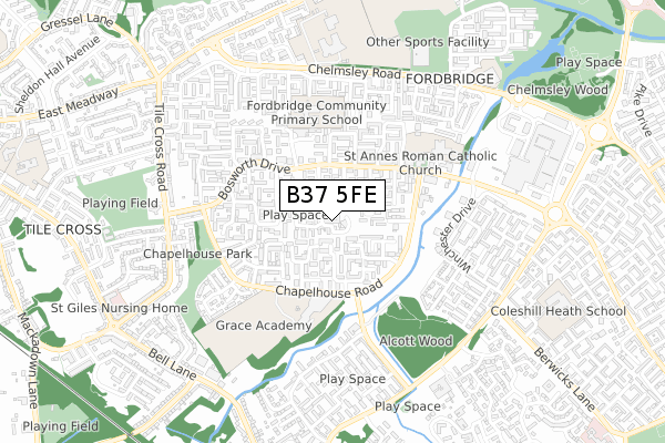
B37 5FE is located in the Kingshurst and Fordbridge electoral ward, within the metropolitan district of Solihull and the English Parliamentary constituency of Meriden. The Sub Integrated Care Board (ICB) Location is NHS Birmingham and Solihull ICB - 15E and the police force is West Midlands. This postcode has been in use since October 2017.


GetTheData
Source: OS Open Zoomstack (Ordnance Survey)
Licence: Open Government Licence (requires attribution)
Attribution: Contains OS data © Crown copyright and database right 2025
Source: Open Postcode Geo
Licence: Open Government Licence (requires attribution)
Attribution: Contains OS data © Crown copyright and database right 2025; Contains Royal Mail data © Royal Mail copyright and database right 2025; Source: Office for National Statistics licensed under the Open Government Licence v.3.0
| Easting | 417000 |
| Northing | 286663 |
| Latitude | 52.477648 |
| Longitude | -1.751125 |
GetTheData
Source: Open Postcode Geo
Licence: Open Government Licence
| Country | England |
| Postcode District | B37 |
➜ See where B37 is on a map ➜ Where is Birmingham? | |
GetTheData
Source: Land Registry Price Paid Data
Licence: Open Government Licence
| Ward | Kingshurst And Fordbridge |
| Constituency | Meriden |
GetTheData
Source: ONS Postcode Database
Licence: Open Government Licence
2024 22 NOV £285,000 |
10, DUNKLEY CRESCENT, FORDBRIDGE, BIRMINGHAM, B37 5FE 2018 28 SEP £194,995 |
12, DUNKLEY CRESCENT, FORDBRIDGE, BIRMINGHAM, B37 5FE 2018 28 SEP £207,500 |
16, DUNKLEY CRESCENT, FORDBRIDGE, BIRMINGHAM, B37 5FE 2018 21 SEP £207,500 |
43, DUNKLEY CRESCENT, FORDBRIDGE, BIRMINGHAM, B37 5FE 2018 20 JUL £217,500 |
2018 13 JUL £227,245 |
35, DUNKLEY CRESCENT, FORDBRIDGE, BIRMINGHAM, B37 5FE 2018 29 JUN £217,995 |
GetTheData
Source: HM Land Registry Price Paid Data
Licence: Contains HM Land Registry data © Crown copyright and database right 2025. This data is licensed under the Open Government Licence v3.0.
| Brickhill Drive (Bosworth Dr) | Fordbridge | 204m |
| Brickhill Drive (Bosworth Dr) | Fordbridge | 219m |
| Coleford Drive (Bosworth Dr) | Fordbridge | 280m |
| Kington Gardens (Chapelhouse Rd) | Fordbridge | 280m |
| Kington Gardens (Chapelhouse Rd) | Fordbridge | 291m |
| Marston Green Station | 1.2km |
| Lea Hall Station | 2.4km |
| Birmingham International Station | 3.4km |
GetTheData
Source: NaPTAN
Licence: Open Government Licence
| Percentage of properties with Next Generation Access | 100.0% |
| Percentage of properties with Superfast Broadband | 100.0% |
| Percentage of properties with Ultrafast Broadband | 100.0% |
| Percentage of properties with Full Fibre Broadband | 0.0% |
Superfast Broadband is between 30Mbps and 300Mbps
Ultrafast Broadband is > 300Mbps
| Median download speed | 37.7Mbps |
| Average download speed | 56.4Mbps |
| Maximum download speed | 350.00Mbps |
| Median upload speed | 1.2Mbps |
| Average upload speed | 3.9Mbps |
| Maximum upload speed | 19.53Mbps |
| Percentage of properties unable to receive 2Mbps | 0.0% |
| Percentage of properties unable to receive 5Mbps | 0.0% |
| Percentage of properties unable to receive 10Mbps | 0.0% |
| Percentage of properties unable to receive 30Mbps | 0.0% |
GetTheData
Source: Ofcom
Licence: Ofcom Terms of Use (requires attribution)
GetTheData
Source: ONS Postcode Database
Licence: Open Government Licence


➜ Get more ratings from the Food Standards Agency
GetTheData
Source: Food Standards Agency
Licence: FSA terms & conditions
| Last Collection | |||
|---|---|---|---|
| Location | Mon-Fri | Sat | Distance |
| Bosworth Drive / Yorklea Croft | 17:00 | 12:30 | 232m |
| Chapelhouse Road | 16:45 | 12:15 | 261m |
| Winchester Drive Near Chinches | 17:15 | 12:30 | 657m |
GetTheData
Source: Dracos
Licence: Creative Commons Attribution-ShareAlike
The below table lists the International Territorial Level (ITL) codes (formerly Nomenclature of Territorial Units for Statistics (NUTS) codes) and Local Administrative Units (LAU) codes for B37 5FE:
| ITL 1 Code | Name |
|---|---|
| TLG | West Midlands (England) |
| ITL 2 Code | Name |
| TLG3 | West Midlands |
| ITL 3 Code | Name |
| TLG32 | Solihull |
| LAU 1 Code | Name |
| E08000029 | Solihull |
GetTheData
Source: ONS Postcode Directory
Licence: Open Government Licence
The below table lists the Census Output Area (OA), Lower Layer Super Output Area (LSOA), and Middle Layer Super Output Area (MSOA) for B37 5FE:
| Code | Name | |
|---|---|---|
| OA | E00051270 | |
| LSOA | E01010143 | Solihull 007C |
| MSOA | E02002087 | Solihull 007 |
GetTheData
Source: ONS Postcode Directory
Licence: Open Government Licence
| B37 5HT | Holly Lodge Walk | 74m |
| B37 5EG | Yorklea Croft | 106m |
| B37 5ED | Maytree Close | 108m |
| B37 5EB | Maytree Close | 123m |
| B37 5HG | Holly Lodge Walk | 129m |
| B37 5HW | Arderne Drive | 136m |
| B37 5HU | Holly Lodge Walk | 143m |
| B37 5HN | Arderne Drive | 145m |
| B37 5HS | Kington Gardens | 153m |
| B37 5EQ | Yorklea Croft | 164m |
GetTheData
Source: Open Postcode Geo; Land Registry Price Paid Data
Licence: Open Government Licence