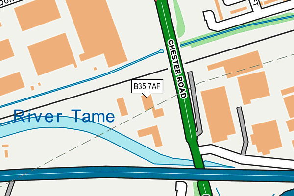
B35 7AF is located in the Pype Hayes electoral ward, within the metropolitan district of Birmingham and the English Parliamentary constituency of Birmingham, Erdington. The Sub Integrated Care Board (ICB) Location is NHS Birmingham and Solihull ICB - 15E and the police force is West Midlands. This postcode has been in use since June 1998.


GetTheData
Source: OS OpenMap – Local (Ordnance Survey)
Source: OS VectorMap District (Ordnance Survey)
Licence: Open Government Licence (requires attribution)
| Easting | 413814 |
| Northing | 290238 |
| Latitude | 52.509876 |
| Longitude | -1.797886 |
GetTheData
Source: Open Postcode Geo
Licence: Open Government Licence
| Country | England |
| Postcode District | B35 |
➜ See where B35 is on a map ➜ Where is Birmingham? | |
GetTheData
Source: Land Registry Price Paid Data
Licence: Open Government Licence
Elevation or altitude of B35 7AF as distance above sea level:
| Metres | Feet | |
|---|---|---|
| Elevation | 80m | 262ft |
Elevation is measured from the approximate centre of the postcode, to the nearest point on an OS contour line from OS Terrain 50, which has contour spacing of ten vertical metres.
➜ How high above sea level am I? Find the elevation of your current position using your device's GPS.
GetTheData
Source: Open Postcode Elevation
Licence: Open Government Licence
| Ward | Pype Hayes |
| Constituency | Birmingham, Erdington |
GetTheData
Source: ONS Postcode Database
Licence: Open Government Licence
| Tameside Drive (Chester Rd) | Bromford | 89m |
| Tameside Drive (Chester Rd) | Bromford | 120m |
| Tangmere Drive (Chester Rd) | Bromford | 293m |
| Hyperion Rd (Bromford Dr) | Bromford | 360m |
| Berrandale Gardens (Newport Rd Ward End) | Buckland End | 397m |
| Stechford Station | 2.9km |
| Lea Hall Station | 3.3km |
| Erdington Station | 3.5km |
GetTheData
Source: NaPTAN
Licence: Open Government Licence
GetTheData
Source: ONS Postcode Database
Licence: Open Government Licence


➜ Get more ratings from the Food Standards Agency
GetTheData
Source: Food Standards Agency
Licence: FSA terms & conditions
| Last Collection | |||
|---|---|---|---|
| Location | Mon-Fri | Sat | Distance |
| Castle Bromwich Del Office | 17:30 | 12:30 | 278m |
| Farnborough Road / Tangmere Dri | 17:15 | 12:30 | 663m |
| Castle Vale Post Office | 17:15 | 12:30 | 898m |
GetTheData
Source: Dracos
Licence: Creative Commons Attribution-ShareAlike
| Risk of B35 7AF flooding from rivers and sea | Very Low |
| ➜ B35 7AF flood map | |
GetTheData
Source: Open Flood Risk by Postcode
Licence: Open Government Licence
The below table lists the International Territorial Level (ITL) codes (formerly Nomenclature of Territorial Units for Statistics (NUTS) codes) and Local Administrative Units (LAU) codes for B35 7AF:
| ITL 1 Code | Name |
|---|---|
| TLG | West Midlands (England) |
| ITL 2 Code | Name |
| TLG3 | West Midlands |
| ITL 3 Code | Name |
| TLG31 | Birmingham |
| LAU 1 Code | Name |
| E08000025 | Birmingham |
GetTheData
Source: ONS Postcode Directory
Licence: Open Government Licence
The below table lists the Census Output Area (OA), Lower Layer Super Output Area (LSOA), and Middle Layer Super Output Area (MSOA) for B35 7AF:
| Code | Name | |
|---|---|---|
| OA | E00046183 | |
| LSOA | E01009101 | Birmingham 029D |
| MSOA | E02001855 | Birmingham 029 |
GetTheData
Source: ONS Postcode Directory
Licence: Open Government Licence
| B36 8RS | Papyrus Way | 270m |
| B36 8PX | The Moors | 278m |
| B36 8PU | Berrandale Road | 297m |
| B35 7EY | Cadbury Drive | 303m |
| B36 8NS | Berrandale Road | 336m |
| B35 7DP | Kenrick Croft | 355m |
| B36 8PS | Riddfield Road | 363m |
| B36 8LP | Kempson Road | 369m |
| B35 7DQ | Avery Croft | 382m |
| B35 7DL | Kenrick Croft | 397m |
GetTheData
Source: Open Postcode Geo; Land Registry Price Paid Data
Licence: Open Government Licence