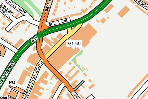
B31 2JU is located in the Northfield electoral ward, within the metropolitan district of Birmingham and the English Parliamentary constituency of Birmingham, Northfield. The Sub Integrated Care Board (ICB) Location is NHS Birmingham and Solihull ICB - 15E and the police force is West Midlands. This postcode has been in use since January 1980.


GetTheData
Source: OS OpenMap – Local (Ordnance Survey)
Source: OS VectorMap District (Ordnance Survey)
Licence: Open Government Licence (requires attribution)
| Easting | 402274 |
| Northing | 279872 |
| Latitude | 52.416839 |
| Longitude | -1.967991 |
GetTheData
Source: Open Postcode Geo
Licence: Open Government Licence
| Country | England |
| Postcode District | B31 |
➜ See where B31 is on a map ➜ Where is Birmingham? | |
GetTheData
Source: Land Registry Price Paid Data
Licence: Open Government Licence
Elevation or altitude of B31 2JU as distance above sea level:
| Metres | Feet | |
|---|---|---|
| Elevation | 180m | 591ft |
Elevation is measured from the approximate centre of the postcode, to the nearest point on an OS contour line from OS Terrain 50, which has contour spacing of ten vertical metres.
➜ How high above sea level am I? Find the elevation of your current position using your device's GPS.
GetTheData
Source: Open Postcode Elevation
Licence: Open Government Licence
| Ward | Northfield |
| Constituency | Birmingham, Northfield |
GetTheData
Source: ONS Postcode Database
Licence: Open Government Licence
| Northfield Shopping Centre (Bristol Road South) | Northfield | 51m |
| Northfield Shopping Centre (Bristol Road South) | Northfield | 54m |
| Bell Lane (Bristol Road South) | Northfield | 103m |
| Bristol Rd (Church Rd) | Northfield | 112m |
| Bristol Rd (Church Rd) | Northfield | 113m |
| Northfield Station | 1km |
| Kings Norton Station | 2.4km |
| Longbridge Station | 2.4km |
GetTheData
Source: NaPTAN
Licence: Open Government Licence
| Median download speed | 20.7Mbps |
| Average download speed | 14.9Mbps |
| Maximum download speed | 22.31Mbps |
| Median upload speed | 0.8Mbps |
| Average upload speed | 0.7Mbps |
| Maximum upload speed | 1.15Mbps |
GetTheData
Source: Ofcom
Licence: Ofcom Terms of Use (requires attribution)
GetTheData
Source: ONS Postcode Database
Licence: Open Government Licence


➜ Get more ratings from the Food Standards Agency
GetTheData
Source: Food Standards Agency
Licence: FSA terms & conditions
| Last Collection | |||
|---|---|---|---|
| Location | Mon-Fri | Sat | Distance |
| Grosvenor Shopping Centre | 17:45 | 12:30 | 47m |
| Northfield Post Office | 17:45 | 12:30 | 261m |
| St Laurence Road / Bristol Road So | 17:45 | 12:30 | 339m |
GetTheData
Source: Dracos
Licence: Creative Commons Attribution-ShareAlike
The below table lists the International Territorial Level (ITL) codes (formerly Nomenclature of Territorial Units for Statistics (NUTS) codes) and Local Administrative Units (LAU) codes for B31 2JU:
| ITL 1 Code | Name |
|---|---|
| TLG | West Midlands (England) |
| ITL 2 Code | Name |
| TLG3 | West Midlands |
| ITL 3 Code | Name |
| TLG31 | Birmingham |
| LAU 1 Code | Name |
| E08000025 | Birmingham |
GetTheData
Source: ONS Postcode Directory
Licence: Open Government Licence
The below table lists the Census Output Area (OA), Lower Layer Super Output Area (LSOA), and Middle Layer Super Output Area (MSOA) for B31 2JU:
| Code | Name | |
|---|---|---|
| OA | E00046734 | |
| LSOA | E01009219 | Birmingham 120E |
| MSOA | E02001946 | Birmingham 120 |
GetTheData
Source: ONS Postcode Directory
Licence: Open Government Licence
| B31 2JT | Bristol Road South | 95m |
| B31 2JZ | Church Road | 102m |
| B31 1JY | Bell Lane | 138m |
| B31 2NN | Bristol Road South | 205m |
| B31 2NG | Bristol Road South | 206m |
| B31 1PF | Ulwine Drive | 209m |
| B31 2LB | Church Road | 209m |
| B31 2PT | Maas Road | 212m |
| B31 2JR | Bristol Road South | 222m |
| B31 2JS | Bristol Road South | 230m |
GetTheData
Source: Open Postcode Geo; Land Registry Price Paid Data
Licence: Open Government Licence