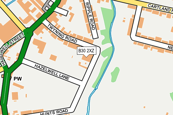
B30 2XZ is located in the Stirchley electoral ward, within the metropolitan district of Birmingham and the English Parliamentary constituency of Birmingham, Selly Oak. The Sub Integrated Care Board (ICB) Location is NHS Birmingham and Solihull ICB - 15E and the police force is West Midlands. This postcode has been in use since January 1980.


GetTheData
Source: OS OpenMap – Local (Ordnance Survey)
Source: OS VectorMap District (Ordnance Survey)
Licence: Open Government Licence (requires attribution)
| Easting | 405660 |
| Northing | 281268 |
| Latitude | 52.429365 |
| Longitude | -1.918184 |
GetTheData
Source: Open Postcode Geo
Licence: Open Government Licence
| Country | England |
| Postcode District | B30 |
➜ See where B30 is on a map ➜ Where is Birmingham? | |
GetTheData
Source: Land Registry Price Paid Data
Licence: Open Government Licence
Elevation or altitude of B30 2XZ as distance above sea level:
| Metres | Feet | |
|---|---|---|
| Elevation | 130m | 427ft |
Elevation is measured from the approximate centre of the postcode, to the nearest point on an OS contour line from OS Terrain 50, which has contour spacing of ten vertical metres.
➜ How high above sea level am I? Find the elevation of your current position using your device's GPS.
GetTheData
Source: Open Postcode Elevation
Licence: Open Government Licence
| Ward | Stirchley |
| Constituency | Birmingham, Selly Oak |
GetTheData
Source: ONS Postcode Database
Licence: Open Government Licence
| Umberslade Rd (Pershore Rd) | Stirchley | 207m |
| Ripple Rd (Cartland Rd) | Stirchley | 230m |
| Ripple Rd (Cartland Rd) | Stirchley | 241m |
| Umberslade Rd (Hazelwell St) | Stirchley | 250m |
| Umberslade Rd (Hazelwell St) | Stirchley | 260m |
| Bournville Station | 0.6km |
| Selly Oak Station | 1.8km |
| Kings Norton Station | 1.9km |
GetTheData
Source: NaPTAN
Licence: Open Government Licence
GetTheData
Source: ONS Postcode Database
Licence: Open Government Licence


➜ Get more ratings from the Food Standards Agency
GetTheData
Source: Food Standards Agency
Licence: FSA terms & conditions
| Last Collection | |||
|---|---|---|---|
| Location | Mon-Fri | Sat | Distance |
| Riverbrook Drive / Cartland Road | 17:45 | 12:30 | 247m |
| O /S Co>op 1437 Pershore Road | 17:30 | 12:30 | 271m |
| Ribblesdale Road | 17:30 | 12:30 | 411m |
GetTheData
Source: Dracos
Licence: Creative Commons Attribution-ShareAlike
| Risk of B30 2XZ flooding from rivers and sea | Medium |
| ➜ B30 2XZ flood map | |
GetTheData
Source: Open Flood Risk by Postcode
Licence: Open Government Licence
The below table lists the International Territorial Level (ITL) codes (formerly Nomenclature of Territorial Units for Statistics (NUTS) codes) and Local Administrative Units (LAU) codes for B30 2XZ:
| ITL 1 Code | Name |
|---|---|
| TLG | West Midlands (England) |
| ITL 2 Code | Name |
| TLG3 | West Midlands |
| ITL 3 Code | Name |
| TLG31 | Birmingham |
| LAU 1 Code | Name |
| E08000025 | Birmingham |
GetTheData
Source: ONS Postcode Directory
Licence: Open Government Licence
The below table lists the Census Output Area (OA), Lower Layer Super Output Area (LSOA), and Middle Layer Super Output Area (MSOA) for B30 2XZ:
| Code | Name | |
|---|---|---|
| OA | E00045415 | |
| LSOA | E01008952 | Birmingham 112B |
| MSOA | E02001938 | Birmingham 112 |
GetTheData
Source: ONS Postcode Directory
Licence: Open Government Licence
| B30 2XY | Twyning Road | 100m |
| B30 2PR | Hazelwell Lane | 112m |
| B30 2RB | Ripple Road | 142m |
| B30 2RA | Ripple Road | 146m |
| B30 2YD | Church Drive | 158m |
| B30 2XU | Pershore Road | 190m |
| B30 2RG | Newlands Road | 193m |
| B30 2YA | Pershore Road | 201m |
| B30 2RE | Cartland Road | 209m |
| B30 2PW | Hunts Road | 216m |
GetTheData
Source: Open Postcode Geo; Land Registry Price Paid Data
Licence: Open Government Licence