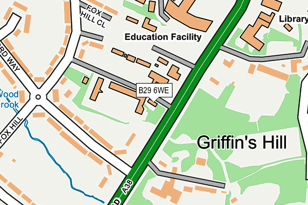
B29 6WE is located in the Weoley & Selly Oak electoral ward, within the metropolitan district of Birmingham and the English Parliamentary constituency of Birmingham, Northfield. The Sub Integrated Care Board (ICB) Location is NHS Birmingham and Solihull ICB - 15E and the police force is West Midlands. This postcode has been in use since January 2004.


GetTheData
Source: OS OpenMap – Local (Ordnance Survey)
Source: OS VectorMap District (Ordnance Survey)
Licence: Open Government Licence (requires attribution)
| Easting | 403597 |
| Northing | 281636 |
| Latitude | 52.432691 |
| Longitude | -1.948521 |
GetTheData
Source: Open Postcode Geo
Licence: Open Government Licence
| Country | England |
| Postcode District | B29 |
➜ See where B29 is on a map ➜ Where is Birmingham? | |
GetTheData
Source: Land Registry Price Paid Data
Licence: Open Government Licence
Elevation or altitude of B29 6WE as distance above sea level:
| Metres | Feet | |
|---|---|---|
| Elevation | 150m | 492ft |
Elevation is measured from the approximate centre of the postcode, to the nearest point on an OS contour line from OS Terrain 50, which has contour spacing of ten vertical metres.
➜ How high above sea level am I? Find the elevation of your current position using your device's GPS.
GetTheData
Source: Open Postcode Elevation
Licence: Open Government Licence
| Ward | Weoley & Selly Oak |
| Constituency | Birmingham, Northfield |
GetTheData
Source: ONS Postcode Database
Licence: Open Government Licence
| Witherford Way (Bristol Rd) | Bournville | 110m |
| Witherford Way (Bristol Rd) | Bournville | 140m |
| Weoley Park Rd (Bristol Rd) | Selly Oak | 315m |
| Westhill Teaching Centre (Weoley Park Rd) | Selly Oak | 356m |
| Bournville Lane (Bristol Road South) | Bournville | 366m |
| Selly Oak Station | 1.3km |
| Bournville Station | 1.6km |
| University Station | 2.2km |
GetTheData
Source: NaPTAN
Licence: Open Government Licence
GetTheData
Source: ONS Postcode Database
Licence: Open Government Licence


➜ Get more ratings from the Food Standards Agency
GetTheData
Source: Food Standards Agency
Licence: FSA terms & conditions
| Last Collection | |||
|---|---|---|---|
| Location | Mon-Fri | Sat | Distance |
| 49 Witherford Way / Fox Hill | 17:45 | 12:30 | 211m |
| Middle Park Road / Bristol Road | 17:45 | 12:30 | 316m |
| Weoley Park Road / Bristol Road | 17:30 | 12:30 | 338m |
GetTheData
Source: Dracos
Licence: Creative Commons Attribution-ShareAlike
The below table lists the International Territorial Level (ITL) codes (formerly Nomenclature of Territorial Units for Statistics (NUTS) codes) and Local Administrative Units (LAU) codes for B29 6WE:
| ITL 1 Code | Name |
|---|---|
| TLG | West Midlands (England) |
| ITL 2 Code | Name |
| TLG3 | West Midlands |
| ITL 3 Code | Name |
| TLG31 | Birmingham |
| LAU 1 Code | Name |
| E08000025 | Birmingham |
GetTheData
Source: ONS Postcode Directory
Licence: Open Government Licence
The below table lists the Census Output Area (OA), Lower Layer Super Output Area (LSOA), and Middle Layer Super Output Area (MSOA) for B29 6WE:
| Code | Name | |
|---|---|---|
| OA | E00047094 | |
| LSOA | E01009294 | Birmingham 099C |
| MSOA | E02001925 | Birmingham 099 |
GetTheData
Source: ONS Postcode Directory
Licence: Open Government Licence
| B29 4AY | Witherford Way | 142m |
| B29 6LX | Bristol Road | 161m |
| B29 4AX | Witherford Way | 179m |
| B29 4AG | Fox Hill | 220m |
| B29 4AH | Fox Hill Close | 222m |
| B29 6LG | Bristol Road | 242m |
| B29 4AT | Fox Hill | 259m |
| B29 4BE | Middle Park Road | 309m |
| B29 4AJ | Witherford Way | 313m |
| B29 4AL | Witherford Close | 316m |
GetTheData
Source: Open Postcode Geo; Land Registry Price Paid Data
Licence: Open Government Licence