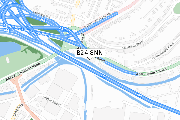
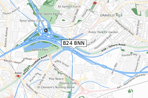
B24 8NN is located in the Gravelly Hill electoral ward, within the metropolitan district of Birmingham and the English Parliamentary constituency of Birmingham, Erdington. The Sub Integrated Care Board (ICB) Location is NHS Birmingham and Solihull ICB - 15E and the police force is West Midlands. This postcode has been in use since April 1987.


GetTheData
Source: OS Open Zoomstack (Ordnance Survey)
Licence: Open Government Licence (requires attribution)
Attribution: Contains OS data © Crown copyright and database right 2025
Source: Open Postcode Geo
Licence: Open Government Licence (requires attribution)
Attribution: Contains OS data © Crown copyright and database right 2025; Contains Royal Mail data © Royal Mail copyright and database right 2025; Source: Office for National Statistics licensed under the Open Government Licence v.3.0
| Easting | 409734 |
| Northing | 290061 |
| Latitude | 52.508358 |
| Longitude | -1.858013 |
GetTheData
Source: Open Postcode Geo
Licence: Open Government Licence
| Country | England |
| Postcode District | B24 |
➜ See where B24 is on a map ➜ Where is Birmingham? | |
GetTheData
Source: Land Registry Price Paid Data
Licence: Open Government Licence
Elevation or altitude of B24 8NN as distance above sea level:
| Metres | Feet | |
|---|---|---|
| Elevation | 100m | 328ft |
Elevation is measured from the approximate centre of the postcode, to the nearest point on an OS contour line from OS Terrain 50, which has contour spacing of ten vertical metres.
➜ How high above sea level am I? Find the elevation of your current position using your device's GPS.
GetTheData
Source: Open Postcode Elevation
Licence: Open Government Licence
| Ward | Gravelly Hill |
| Constituency | Birmingham, Erdington |
GetTheData
Source: ONS Postcode Database
Licence: Open Government Licence
| Salford Circus (Tyburn Rd) | Salford Bridge | 43m |
| Salford Circus (Tyburn Rd) | Salford Bridge | 52m |
| Salford Circus (Gravelly Hill) | Salford Bridge | 160m |
| Salford Circus (Gravelly Hill) | Salford Bridge | 200m |
| Armada Close (Gravelly Hill) | Salford Bridge | 265m |
| Gravelly Hill Station | 0.8km |
| Aston Station | 1.1km |
| Witton (West Midlands) Station | 1.8km |
GetTheData
Source: NaPTAN
Licence: Open Government Licence
GetTheData
Source: ONS Postcode Database
Licence: Open Government Licence


➜ Get more ratings from the Food Standards Agency
GetTheData
Source: Food Standards Agency
Licence: FSA terms & conditions
| Last Collection | |||
|---|---|---|---|
| Location | Mon-Fri | Sat | Distance |
| Gravell Hill | 17:45 | 12:30 | 273m |
| Star City Leisure Complex | 18:30 | 12:30 | 412m |
| Long Acre | 17:30 | 12:30 | 420m |
GetTheData
Source: Dracos
Licence: Creative Commons Attribution-ShareAlike
The below table lists the International Territorial Level (ITL) codes (formerly Nomenclature of Territorial Units for Statistics (NUTS) codes) and Local Administrative Units (LAU) codes for B24 8NN:
| ITL 1 Code | Name |
|---|---|
| TLG | West Midlands (England) |
| ITL 2 Code | Name |
| TLG3 | West Midlands |
| ITL 3 Code | Name |
| TLG31 | Birmingham |
| LAU 1 Code | Name |
| E08000025 | Birmingham |
GetTheData
Source: ONS Postcode Directory
Licence: Open Government Licence
The below table lists the Census Output Area (OA), Lower Layer Super Output Area (LSOA), and Middle Layer Super Output Area (MSOA) for B24 8NN:
| Code | Name | |
|---|---|---|
| OA | E00047651 | |
| LSOA | E01009401 | Birmingham 031F |
| MSOA | E02001857 | Birmingham 031 |
GetTheData
Source: ONS Postcode Directory
Licence: Open Government Licence
| B24 8PS | Minstead Road | 128m |
| B24 8PT | Minstead Road | 172m |
| B23 7JY | Gravelly Hill | 190m |
| B6 7SP | Lichfield Road | 229m |
| B23 7PG | Slade Road | 302m |
| B23 7NY | Powick Road | 309m |
| B23 7PH | Copeley Hill | 329m |
| B23 7PB | Armada Close | 329m |
| B24 8LE | Hawkesyard Road | 353m |
| B24 8LR | Tyburn Road | 358m |
GetTheData
Source: Open Postcode Geo; Land Registry Price Paid Data
Licence: Open Government Licence