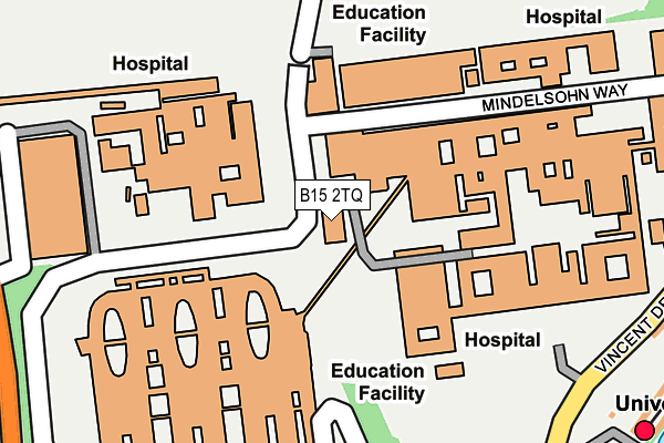
B15 2TQ is located in the Edgbaston electoral ward, within the metropolitan district of Birmingham and the English Parliamentary constituency of Birmingham, Edgbaston. The Sub Integrated Care Board (ICB) Location is NHS Birmingham and Solihull ICB - 15E and the police force is West Midlands. This postcode has been in use since March 1982.


GetTheData
Source: OS OpenMap – Local (Ordnance Survey)
Source: OS VectorMap District (Ordnance Survey)
Licence: Open Government Licence (requires attribution)
| Easting | 404101 |
| Northing | 283857 |
| Latitude | 52.452654 |
| Longitude | -1.941081 |
GetTheData
Source: Open Postcode Geo
Licence: Open Government Licence
| Country | England |
| Postcode District | B15 |
➜ See where B15 is on a map ➜ Where is Birmingham? | |
GetTheData
Source: Land Registry Price Paid Data
Licence: Open Government Licence
Elevation or altitude of B15 2TQ as distance above sea level:
| Metres | Feet | |
|---|---|---|
| Elevation | 150m | 492ft |
Elevation is measured from the approximate centre of the postcode, to the nearest point on an OS contour line from OS Terrain 50, which has contour spacing of ten vertical metres.
➜ How high above sea level am I? Find the elevation of your current position using your device's GPS.
GetTheData
Source: Open Postcode Elevation
Licence: Open Government Licence
| Ward | Edgbaston |
| Constituency | Birmingham, Edgbaston |
GetTheData
Source: ONS Postcode Database
Licence: Open Government Licence
| Queen Elizabeth Hospital (Metchley Park Rd) | Queen Elizabeth Hospital | 84m |
| Queen Elizabeth Hospital (Metchley Park Rd) | Queen Elizabeth Hospital | 106m |
| Queen Elizabeth Hospital (Hospital Way) | Queen Elizabeth Hospital | 171m |
| Queen Elizabeth Hospital (Hospital Way) | Queen Elizabeth Hospital | 184m |
| Queen Elizabeth Hospital (Hospital Way) | Queen Elizabeth Hospital | 193m |
| University Station | 0.3km |
| Selly Oak Station | 1.2km |
| Five Ways Station | 2.8km |
GetTheData
Source: NaPTAN
Licence: Open Government Licence
GetTheData
Source: ONS Postcode Database
Licence: Open Government Licence


➜ Get more ratings from the Food Standards Agency
GetTheData
Source: Food Standards Agency
Licence: FSA terms & conditions
| Last Collection | |||
|---|---|---|---|
| Location | Mon-Fri | Sat | Distance |
| Metchley Park Road | 17:30 | 12:30 | 303m |
| Matchley Lane | 17:30 | 12:00 | 337m |
| Metchley Drive / Malins Road | 17:30 | 12:00 | 606m |
GetTheData
Source: Dracos
Licence: Creative Commons Attribution-ShareAlike
The below table lists the International Territorial Level (ITL) codes (formerly Nomenclature of Territorial Units for Statistics (NUTS) codes) and Local Administrative Units (LAU) codes for B15 2TQ:
| ITL 1 Code | Name |
|---|---|
| TLG | West Midlands (England) |
| ITL 2 Code | Name |
| TLG3 | West Midlands |
| ITL 3 Code | Name |
| TLG31 | Birmingham |
| LAU 1 Code | Name |
| E08000025 | Birmingham |
GetTheData
Source: ONS Postcode Directory
Licence: Open Government Licence
The below table lists the Census Output Area (OA), Lower Layer Super Output Area (LSOA), and Middle Layer Super Output Area (MSOA) for B15 2TQ:
| Code | Name | |
|---|---|---|
| OA | E00175615 | |
| LSOA | E01033562 | Birmingham 087F |
| MSOA | E02001913 | Birmingham 087 |
GetTheData
Source: ONS Postcode Directory
Licence: Open Government Licence
| B17 0JH | Metchley Lane | 353m |
| B15 2PQ | Metchley Park Road | 354m |
| B17 0JP | Metchley Court | 376m |
| B17 0JL | Metchley Lane | 376m |
| B17 0JS | Old Abbey Gardens | 407m |
| B15 2SX | Underwood Close | 408m |
| B17 0JR | Theodore Close | 410m |
| B17 0NN | Metfield Croft | 411m |
| B17 0HU | Griffin Gardens | 441m |
| B17 0NZ | Cross Farm Road | 450m |
GetTheData
Source: Open Postcode Geo; Land Registry Price Paid Data
Licence: Open Government Licence