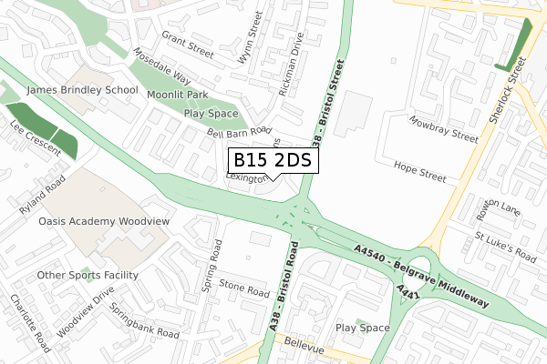
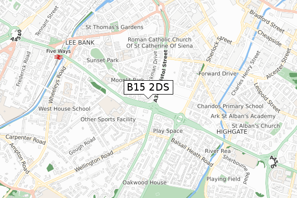
B15 2DS is in Foxgrove Road, Birmingham. B15 2DS is located in the Ladywood electoral ward, within the metropolitan district of Birmingham and the English Parliamentary constituency of Birmingham, Ladywood. The Sub Integrated Care Board (ICB) Location is NHS Birmingham and Solihull ICB - 15E and the police force is West Midlands. This postcode has been in use since September 2017.


GetTheData
Source: OS Open Zoomstack (Ordnance Survey)
Licence: Open Government Licence (requires attribution)
Attribution: Contains OS data © Crown copyright and database right 2025
Source: Open Postcode Geo
Licence: Open Government Licence (requires attribution)
Attribution: Contains OS data © Crown copyright and database right 2025; Contains Royal Mail data © Royal Mail copyright and database right 2025; Source: Office for National Statistics licensed under the Open Government Licence v.3.0
| Easting | 406762 |
| Northing | 285565 |
| Latitude | 52.467998 |
| Longitude | -1.901886 |
GetTheData
Source: Open Postcode Geo
Licence: Open Government Licence
| Locality | Foxgrove Road |
| Town/City | Birmingham |
| Country | England |
| Postcode District | B15 |
➜ See where B15 is on a map ➜ Where is Birmingham? | |
GetTheData
Source: Land Registry Price Paid Data
Licence: Open Government Licence
| Ward | Ladywood |
| Constituency | Birmingham, Ladywood |
GetTheData
Source: ONS Postcode Database
Licence: Open Government Licence
| Rickman Drive (Bristol Street) | Lee Bank | 48m |
| Spring St (Lee Bank Middleway) | Lee Bank | 66m |
| Rickman Drive (Bristol Street) | Lee Bank | 86m |
| Spring St (Lee Bank Middleway) | Lee Bank | 156m |
| Stone Rd (Bristol Rd) | Lee Bank | 182m |
| Grand Central New Street (Midland Metro Stop) (Stephenson Street) | Birmingham | 1,196m |
| Corporation Street (Midland Metro Stop) (Corporation Street) | Birmingham | 1,358m |
| Five Ways Station | 0.8km |
| Birmingham New Street Station | 1.1km |
| Birmingham Moor Street Station | 1.4km |
GetTheData
Source: NaPTAN
Licence: Open Government Licence
| Percentage of properties with Next Generation Access | 100.0% |
| Percentage of properties with Superfast Broadband | 100.0% |
| Percentage of properties with Ultrafast Broadband | 100.0% |
| Percentage of properties with Full Fibre Broadband | 100.0% |
Superfast Broadband is between 30Mbps and 300Mbps
Ultrafast Broadband is > 300Mbps
| Percentage of properties unable to receive 2Mbps | 0.0% |
| Percentage of properties unable to receive 5Mbps | 0.0% |
| Percentage of properties unable to receive 10Mbps | 0.0% |
| Percentage of properties unable to receive 30Mbps | 0.0% |
GetTheData
Source: Ofcom
Licence: Ofcom Terms of Use (requires attribution)
GetTheData
Source: ONS Postcode Database
Licence: Open Government Licence


➜ Get more ratings from the Food Standards Agency
GetTheData
Source: Food Standards Agency
Licence: FSA terms & conditions
| Last Collection | |||
|---|---|---|---|
| Location | Mon-Fri | Sat | Distance |
| Rickman Drive / Bell Barn Road | 17:30 | 12:30 | 97m |
| Wellington Road / Bristol Road | 17:30 | 12:30 | 319m |
| Spooner Croft / Gooch St | 17:30 | 12:30 | 478m |
GetTheData
Source: Dracos
Licence: Creative Commons Attribution-ShareAlike
The below table lists the International Territorial Level (ITL) codes (formerly Nomenclature of Territorial Units for Statistics (NUTS) codes) and Local Administrative Units (LAU) codes for B15 2DS:
| ITL 1 Code | Name |
|---|---|
| TLG | West Midlands (England) |
| ITL 2 Code | Name |
| TLG3 | West Midlands |
| ITL 3 Code | Name |
| TLG31 | Birmingham |
| LAU 1 Code | Name |
| E08000025 | Birmingham |
GetTheData
Source: ONS Postcode Directory
Licence: Open Government Licence
The below table lists the Census Output Area (OA), Lower Layer Super Output Area (LSOA), and Middle Layer Super Output Area (MSOA) for B15 2DS:
| Code | Name | |
|---|---|---|
| OA | E00046411 | |
| LSOA | E01033640 | Birmingham 134E |
| MSOA | E02006895 | Birmingham 134 |
GetTheData
Source: ONS Postcode Directory
Licence: Open Government Licence
| B15 2DZ | 34m | |
| B15 2DR | Bexhill Grove | 55m |
| B15 2AN | Rickman Drive | 66m |
| B15 2GQ | Madison Walk | 117m |
| B15 2BF | Rickman Drive | 137m |
| B15 2DJ | Bell Barn Road | 148m |
| B15 2GP | Madison Walk | 154m |
| B15 2GH | Springmeadow Road | 158m |
| B15 2DH | Bell Barn Road | 172m |
| B15 2DL | Windrush Grove | 200m |
GetTheData
Source: Open Postcode Geo; Land Registry Price Paid Data
Licence: Open Government Licence