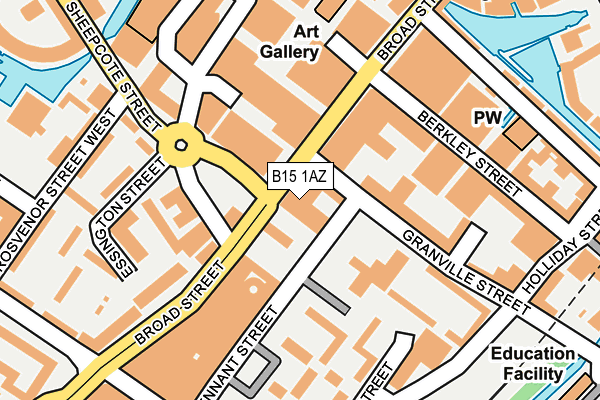
B15 1AZ is located in the Ladywood electoral ward, within the metropolitan district of Birmingham and the English Parliamentary constituency of Birmingham, Ladywood. The Sub Integrated Care Board (ICB) Location is NHS Birmingham and Solihull ICB - 15E and the police force is West Midlands. This postcode has been in use since January 1980.


GetTheData
Source: OS OpenMap – Local (Ordnance Survey)
Source: OS VectorMap District (Ordnance Survey)
Licence: Open Government Licence (requires attribution)
| Easting | 406017 |
| Northing | 286449 |
| Latitude | 52.475939 |
| Longitude | -1.912842 |
GetTheData
Source: Open Postcode Geo
Licence: Open Government Licence
| Country | England |
| Postcode District | B15 |
➜ See where B15 is on a map ➜ Where is Birmingham? | |
GetTheData
Source: Land Registry Price Paid Data
Licence: Open Government Licence
Elevation or altitude of B15 1AZ as distance above sea level:
| Metres | Feet | |
|---|---|---|
| Elevation | 140m | 459ft |
Elevation is measured from the approximate centre of the postcode, to the nearest point on an OS contour line from OS Terrain 50, which has contour spacing of ten vertical metres.
➜ How high above sea level am I? Find the elevation of your current position using your device's GPS.
GetTheData
Source: Open Postcode Elevation
Licence: Open Government Licence
| Ward | Ladywood |
| Constituency | Birmingham, Ladywood |
GetTheData
Source: ONS Postcode Database
Licence: Open Government Licence
| Sheepcote St (Broad St) | Five Ways | 91m |
| Brindley Place (Broad St) | International Convention Centre | 100m |
| Sheepcote St (Broad St) | Five Ways | 100m |
| Sheepcote St (Broad St) | Five Ways | 101m |
| Brindley Place (Broad St) | International Convention Centre | 108m |
| Grand Central New Street (Midland Metro Stop) (Stephenson Street) | Birmingham | 966m |
| Corporation Street (Midland Metro Stop) (Corporation Street) | Birmingham | 1,149m |
| Snow Hill (Midland Metro Stop) (Colmore Row) | Birmingham | 1,259m |
| Bull Street (Midland Metro Stop) (Bull Street) | Birmingham | 1,302m |
| St Paul's (Midland Metro Stop) (Livery Street) | Jewellery Quarter | 1,337m |
| Five Ways Station | 0.5km |
| Birmingham New Street Station | 0.9km |
| Birmingham Snow Hill Station | 1.2km |
GetTheData
Source: NaPTAN
Licence: Open Government Licence
GetTheData
Source: ONS Postcode Database
Licence: Open Government Licence


➜ Get more ratings from the Food Standards Agency
GetTheData
Source: Food Standards Agency
Licence: FSA terms & conditions
| Last Collection | |||
|---|---|---|---|
| Location | Mon-Fri | Sat | Distance |
| Granville Square | 16:45 | 12:30 | 204m |
| Brindley Place | 18:30 | 12:30 | 205m |
| Sheepcotestreet | 17:30 | 12:30 | 232m |
GetTheData
Source: Dracos
Licence: Creative Commons Attribution-ShareAlike
The below table lists the International Territorial Level (ITL) codes (formerly Nomenclature of Territorial Units for Statistics (NUTS) codes) and Local Administrative Units (LAU) codes for B15 1AZ:
| ITL 1 Code | Name |
|---|---|
| TLG | West Midlands (England) |
| ITL 2 Code | Name |
| TLG3 | West Midlands |
| ITL 3 Code | Name |
| TLG31 | Birmingham |
| LAU 1 Code | Name |
| E08000025 | Birmingham |
GetTheData
Source: ONS Postcode Directory
Licence: Open Government Licence
The below table lists the Census Output Area (OA), Lower Layer Super Output Area (LSOA), and Middle Layer Super Output Area (MSOA) for B15 1AZ:
| Code | Name | |
|---|---|---|
| OA | E00046379 | |
| LSOA | E01009146 | Birmingham 136B |
| MSOA | E02006897 | Birmingham 136 |
GetTheData
Source: ONS Postcode Directory
Licence: Open Government Licence
| B1 2HG | Broad Street | 74m |
| B15 1UE | Granville Square | 98m |
| B15 1UG | Granville Square | 98m |
| B15 1UH | Granville Square | 98m |
| B15 1UQ | Granville Square | 98m |
| B15 1AY | Broad Street | 103m |
| B1 2LJ | Granville Street | 106m |
| B1 2LS | Granville Street | 106m |
| B15 1EH | Stoke Way | 147m |
| B1 2LL | Upper William Street | 160m |
GetTheData
Source: Open Postcode Geo; Land Registry Price Paid Data
Licence: Open Government Licence