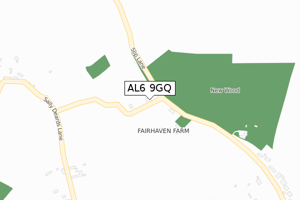
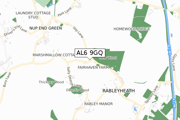
AL6 9GQ is located in the Knebworth electoral ward, within the local authority district of North Hertfordshire and the English Parliamentary constituency of Stevenage. The Sub Integrated Care Board (ICB) Location is NHS Hertfordshire and West Essex ICB - 06K and the police force is Hertfordshire. This postcode has been in use since April 2019.


GetTheData
Source: OS Open Zoomstack (Ordnance Survey)
Licence: Open Government Licence (requires attribution)
Attribution: Contains OS data © Crown copyright and database right 2025
Source: Open Postcode Geo
Licence: Open Government Licence (requires attribution)
Attribution: Contains OS data © Crown copyright and database right 2025; Contains Royal Mail data © Royal Mail copyright and database right 2025; Source: Office for National Statistics licensed under the Open Government Licence v.3.0
| Easting | 523173 |
| Northing | 219521 |
| Latitude | 51.860694 |
| Longitude | -0.212710 |
GetTheData
Source: Open Postcode Geo
Licence: Open Government Licence
| Country | England |
| Postcode District | AL6 |
➜ See where AL6 is on a map | |
GetTheData
Source: Land Registry Price Paid Data
Licence: Open Government Licence
| Ward | Knebworth |
| Constituency | Stevenage |
GetTheData
Source: ONS Postcode Database
Licence: Open Government Licence
| The Green (Park Lane) | Nup End | 752m |
| The Green | Nup End | 767m |
| Lytton Arms Ph (Park Lane) | Old Knebworth | 774m |
| Lytton Arms Ph (Park Lane) | Old Knebworth | 785m |
| Playing Field (Park Lane) | Old Knebworth | 924m |
| Knebworth Station | 1.9km |
| Welwyn North Station | 4.4km |
| Stevenage Station | 4.6km |
GetTheData
Source: NaPTAN
Licence: Open Government Licence
GetTheData
Source: ONS Postcode Database
Licence: Open Government Licence


➜ Get more ratings from the Food Standards Agency
GetTheData
Source: Food Standards Agency
Licence: FSA terms & conditions
| Last Collection | |||
|---|---|---|---|
| Location | Mon-Fri | Sat | Distance |
| Nup End Green | 16:15 | 08:30 | 762m |
| Old Knebworth | 16:15 | 08:30 | 919m |
| Park Lane | 16:00 | 09:00 | 927m |
GetTheData
Source: Dracos
Licence: Creative Commons Attribution-ShareAlike
The below table lists the International Territorial Level (ITL) codes (formerly Nomenclature of Territorial Units for Statistics (NUTS) codes) and Local Administrative Units (LAU) codes for AL6 9GQ:
| ITL 1 Code | Name |
|---|---|
| TLH | East |
| ITL 2 Code | Name |
| TLH2 | Bedfordshire and Hertfordshire |
| ITL 3 Code | Name |
| TLH23 | Hertfordshire CC |
| LAU 1 Code | Name |
| E07000099 | North Hertfordshire |
GetTheData
Source: ONS Postcode Directory
Licence: Open Government Licence
The below table lists the Census Output Area (OA), Lower Layer Super Output Area (LSOA), and Middle Layer Super Output Area (MSOA) for AL6 9GQ:
| Code | Name | |
|---|---|---|
| OA | E00119991 | |
| LSOA | E01023627 | North Hertfordshire 015D |
| MSOA | E02004923 | North Hertfordshire 015 |
GetTheData
Source: ONS Postcode Directory
Licence: Open Government Licence
| AL6 9UE | Sally Deards Lane | 375m |
| AL6 9UF | 474m | |
| AL6 9UB | 574m | |
| AL6 9UD | 618m | |
| AL6 9UG | 686m | |
| SG3 6QG | Slip Lane | 691m |
| AL6 9TJ | Tagmore Park | 723m |
| SG3 6QF | Park Lane | 726m |
| SG3 6QN | The Green | 763m |
| SG3 6QB | Park Lane | 857m |
GetTheData
Source: Open Postcode Geo; Land Registry Price Paid Data
Licence: Open Government Licence