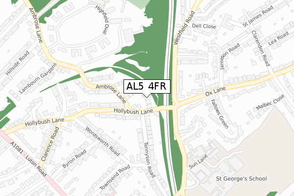
AL5 4FR is located in the Harpenden West electoral ward, within the local authority district of St Albans and the English Parliamentary constituency of Hitchin and Harpenden. The Sub Integrated Care Board (ICB) Location is NHS Hertfordshire and West Essex ICB - 06N and the police force is Hertfordshire. This postcode has been in use since April 2020.


GetTheData
Source: OS Open Zoomstack (Ordnance Survey)
Licence: Open Government Licence (requires attribution)
Attribution: Contains OS data © Crown copyright and database right 2024
Source: Open Postcode Geo
Licence: Open Government Licence (requires attribution)
Attribution: Contains OS data © Crown copyright and database right 2024; Contains Royal Mail data © Royal Mail copyright and database right 2024; Source: Office for National Statistics licensed under the Open Government Licence v.3.0
| Easting | 513359 |
| Northing | 215187 |
| Latitude | 51.823822 |
| Longitude | -0.356577 |
GetTheData
Source: Open Postcode Geo
Licence: Open Government Licence
| Country | England |
| Postcode District | AL5 |
➜ See where AL5 is on a map ➜ Where is Harpenden? | |
GetTheData
Source: Land Registry Price Paid Data
Licence: Open Government Licence
| Ward | Harpenden West |
| Constituency | Hitchin And Harpenden |
GetTheData
Source: ONS Postcode Database
Licence: Open Government Licence
| Ox Lane (Sun Lane) | Harpenden | 114m |
| Ox Lane (Sun Lane) | Harpenden | 122m |
| Ox Lane West (Ox Lane) | Harpenden | 184m |
| St Georges School (Sun Lane) | Harpenden | 233m |
| St Georges School (Sun Lane) | Harpenden | 264m |
| Harpenden Station | 1.1km |
GetTheData
Source: NaPTAN
Licence: Open Government Licence
GetTheData
Source: ONS Postcode Database
Licence: Open Government Licence


➜ Get more ratings from the Food Standards Agency
GetTheData
Source: Food Standards Agency
Licence: FSA terms & conditions
| Last Collection | |||
|---|---|---|---|
| Location | Mon-Fri | Sat | Distance |
| Wordsworth Road | 18:30 | 11:45 | 195m |
| Ambrose Lane | 18:30 | 12:00 | 353m |
| Ox Lane | 18:30 | 11:45 | 424m |
GetTheData
Source: Dracos
Licence: Creative Commons Attribution-ShareAlike
The below table lists the International Territorial Level (ITL) codes (formerly Nomenclature of Territorial Units for Statistics (NUTS) codes) and Local Administrative Units (LAU) codes for AL5 4FR:
| ITL 1 Code | Name |
|---|---|
| TLH | East |
| ITL 2 Code | Name |
| TLH2 | Bedfordshire and Hertfordshire |
| ITL 3 Code | Name |
| TLH23 | Hertfordshire CC |
| LAU 1 Code | Name |
| E07000240 | St Albans |
GetTheData
Source: ONS Postcode Directory
Licence: Open Government Licence
The below table lists the Census Output Area (OA), Lower Layer Super Output Area (LSOA), and Middle Layer Super Output Area (MSOA) for AL5 4FR:
| Code | Name | |
|---|---|---|
| OA | E00120363 | |
| LSOA | E01023699 | St Albans 003A |
| MSOA | E02004926 | St Albans 003 |
GetTheData
Source: ONS Postcode Directory
Licence: Open Government Licence
| AL5 4AY | Hollybush Lane | 45m |
| AL5 4BA | Hollybush Lane | 56m |
| AL5 4AT | Hollybush Lane | 107m |
| AL5 4HJ | Ox Lane | 114m |
| AL5 4AX | Ambrose Lane | 118m |
| AL5 4HA | Sun Lane | 129m |
| AL5 4HL | Westfield Road | 134m |
| AL5 4AS | Hollybush Lane | 136m |
| AL5 4BD | Tennyson Road | 139m |
| AL5 4HB | Ox Lane | 160m |
GetTheData
Source: Open Postcode Geo; Land Registry Price Paid Data
Licence: Open Government Licence