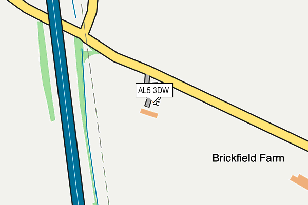
AL5 3DW is located in the Harpenden North & Rural electoral ward, within the local authority district of St Albans and the English Parliamentary constituency of Hitchin and Harpenden. The Sub Integrated Care Board (ICB) Location is NHS Hertfordshire and West Essex ICB - 06N and the police force is Hertfordshire. This postcode has been in use since March 2017.


GetTheData
Source: OS OpenMap – Local (Ordnance Survey)
Source: OS VectorMap District (Ordnance Survey)
Licence: Open Government Licence (requires attribution)
| Easting | 509186 |
| Northing | 216134 |
| Latitude | 51.833164 |
| Longitude | -0.416803 |
GetTheData
Source: Open Postcode Geo
Licence: Open Government Licence
| Country | England |
| Postcode District | AL5 |
➜ See where AL5 is on a map | |
GetTheData
Source: Land Registry Price Paid Data
Licence: Open Government Licence
| Ward | Harpenden North & Rural |
| Constituency | Hitchin And Harpenden |
GetTheData
Source: ONS Postcode Database
Licence: Open Government Licence
| Gibraltar Farm (London Road) | Kinsbourne Green | 1,193m |
| Gibraltar Farm (London Road) | Kinsbourne Green | 1,214m |
| Chequers Hill | Friar's Wash | 1,303m |
| Chequers Hill | Friar's Wash | 1,308m |
| Watery Lane (Watling Street) | Friar's Wash | 1,340m |
| Luton Airport Parkway Station | 4.6km |
| Harpenden Station | 5km |
GetTheData
Source: NaPTAN
Licence: Open Government Licence
| Percentage of properties with Next Generation Access | 100.0% |
| Percentage of properties with Superfast Broadband | 0.0% |
| Percentage of properties with Ultrafast Broadband | 0.0% |
| Percentage of properties with Full Fibre Broadband | 0.0% |
Superfast Broadband is between 30Mbps and 300Mbps
Ultrafast Broadband is > 300Mbps
| Percentage of properties unable to receive 2Mbps | 0.0% |
| Percentage of properties unable to receive 5Mbps | 100.0% |
| Percentage of properties unable to receive 10Mbps | 100.0% |
| Percentage of properties unable to receive 30Mbps | 100.0% |
GetTheData
Source: Ofcom
Licence: Ofcom Terms of Use (requires attribution)
GetTheData
Source: ONS Postcode Database
Licence: Open Government Licence


➜ Get more ratings from the Food Standards Agency
GetTheData
Source: Food Standards Agency
Licence: FSA terms & conditions
| Last Collection | |||
|---|---|---|---|
| Location | Mon-Fri | Sat | Distance |
| Annables | 17:00 | 11:45 | 1,018m |
| Flamstead P.o | 18:15 | 10:30 | 1,949m |
| Luton Hoo | 17:00 | 07:30 | 1,961m |
GetTheData
Source: Dracos
Licence: Creative Commons Attribution-ShareAlike
The below table lists the International Territorial Level (ITL) codes (formerly Nomenclature of Territorial Units for Statistics (NUTS) codes) and Local Administrative Units (LAU) codes for AL5 3DW:
| ITL 1 Code | Name |
|---|---|
| TLH | East |
| ITL 2 Code | Name |
| TLH2 | Bedfordshire and Hertfordshire |
| ITL 3 Code | Name |
| TLH23 | Hertfordshire CC |
| LAU 1 Code | Name |
| E07000240 | St Albans |
GetTheData
Source: ONS Postcode Directory
Licence: Open Government Licence
The below table lists the Census Output Area (OA), Lower Layer Super Output Area (LSOA), and Middle Layer Super Output Area (MSOA) for AL5 3DW:
| Code | Name | |
|---|---|---|
| OA | E00120457 | |
| LSOA | E01023725 | St Albans 006D |
| MSOA | E02004929 | St Albans 006 |
GetTheData
Source: ONS Postcode Directory
Licence: Open Government Licence
| AL5 3PY | Coles Lane | 396m |
| AL5 3PZ | Kinsbourne Green | 433m |
| AL5 3PR | Annables Lane | 1043m |
| AL5 3PS | Annables Lane | 1044m |
| AL5 3PP | Spring Road | 1168m |
| AL5 3PN | Annables Lane | 1214m |
| LU1 4LH | Pepsal End | 1242m |
| AL3 8EX | Watery Lane | 1243m |
| AL5 3PL | Annables Lane | 1279m |
| AL5 3PW | Chamberlaines | 1293m |
GetTheData
Source: Open Postcode Geo; Land Registry Price Paid Data
Licence: Open Government Licence