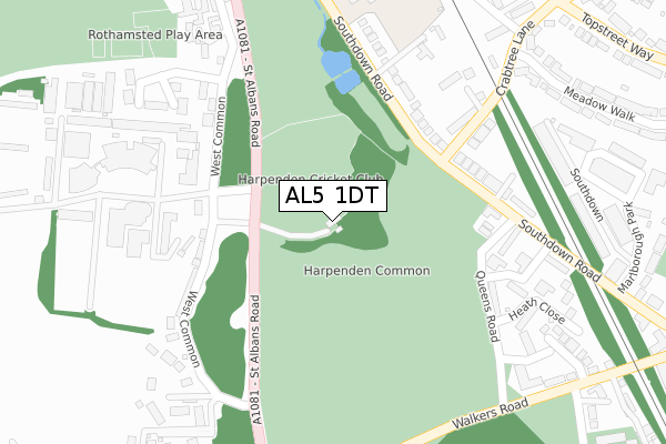
AL5 1DT is located in the Harpenden West electoral ward, within the local authority district of St Albans and the English Parliamentary constituency of Hitchin and Harpenden. The Sub Integrated Care Board (ICB) Location is NHS Hertfordshire and West Essex ICB - 06N and the police force is Hertfordshire. This postcode has been in use since January 2020.


GetTheData
Source: OS Open Zoomstack (Ordnance Survey)
Licence: Open Government Licence (requires attribution)
Attribution: Contains OS data © Crown copyright and database right 2025
Source: Open Postcode Geo
Licence: Open Government Licence (requires attribution)
Attribution: Contains OS data © Crown copyright and database right 2025; Contains Royal Mail data © Royal Mail copyright and database right 2025; Source: Office for National Statistics licensed under the Open Government Licence v.3.0
| Easting | 513722 |
| Northing | 213509 |
| Latitude | 51.808667 |
| Longitude | -0.351863 |
GetTheData
Source: Open Postcode Geo
Licence: Open Government Licence
| Country | England |
| Postcode District | AL5 |
➜ See where AL5 is on a map ➜ Where is Harpenden? | |
GetTheData
Source: Land Registry Price Paid Data
Licence: Open Government Licence
| Ward | Harpenden West |
| Constituency | Hitchin And Harpenden |
GetTheData
Source: ONS Postcode Database
Licence: Open Government Licence
| Crabtree Lane (Southdown Road) | Harpenden | 170m |
| Crabtree Lane (Southdown Road) | Harpenden | 209m |
| Harpenden House Hotel (Southdown Road) | Harpenden | 340m |
| Harpenden House Hotel (Southdown Road) | Harpenden | 386m |
| Queens Road (Walkers Road) | Harpenden | 388m |
| Harpenden Station | 0.7km |
GetTheData
Source: NaPTAN
Licence: Open Government Licence
GetTheData
Source: ONS Postcode Database
Licence: Open Government Licence


➜ Get more ratings from the Food Standards Agency
GetTheData
Source: Food Standards Agency
Licence: FSA terms & conditions
| Last Collection | |||
|---|---|---|---|
| Location | Mon-Fri | Sat | Distance |
| Queens Road | 17:45 | 12:00 | 267m |
| Coach Lane | 17:45 | 12:00 | 297m |
| Topstreet Way | 17:45 | 12:15 | 536m |
GetTheData
Source: Dracos
Licence: Creative Commons Attribution-ShareAlike
The below table lists the International Territorial Level (ITL) codes (formerly Nomenclature of Territorial Units for Statistics (NUTS) codes) and Local Administrative Units (LAU) codes for AL5 1DT:
| ITL 1 Code | Name |
|---|---|
| TLH | East |
| ITL 2 Code | Name |
| TLH2 | Bedfordshire and Hertfordshire |
| ITL 3 Code | Name |
| TLH23 | Hertfordshire CC |
| LAU 1 Code | Name |
| E07000240 | St Albans |
GetTheData
Source: ONS Postcode Directory
Licence: Open Government Licence
The below table lists the Census Output Area (OA), Lower Layer Super Output Area (LSOA), and Middle Layer Super Output Area (MSOA) for AL5 1DT:
| Code | Name | |
|---|---|---|
| OA | E00120346 | |
| LSOA | E01023701 | St Albans 003C |
| MSOA | E02004926 | St Albans 003 |
GetTheData
Source: ONS Postcode Directory
Licence: Open Government Licence
| AL5 1PG | Southdown Road | 216m |
| AL5 2JN | West Common | 226m |
| AL5 1PQ | Southdown Road | 237m |
| AL5 5TB | Crabtree Lane | 258m |
| AL5 1NY | Kings Court | 263m |
| AL5 1QR | Queens Road | 267m |
| AL5 5TA | Crabtree Lane | 270m |
| AL5 1QW | Queens Road | 272m |
| AL5 1QU | Southdown Road | 283m |
| AL5 1PF | Southdown Road | 286m |
GetTheData
Source: Open Postcode Geo; Land Registry Price Paid Data
Licence: Open Government Licence