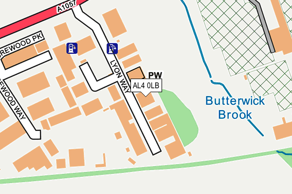
AL4 0LB is located in the Hill End electoral ward, within the local authority district of St Albans and the English Parliamentary constituency of St Albans. The Sub Integrated Care Board (ICB) Location is NHS Hertfordshire and West Essex ICB - 06N and the police force is Hertfordshire. This postcode has been in use since January 1980.


GetTheData
Source: OS OpenMap – Local (Ordnance Survey)
Source: OS VectorMap District (Ordnance Survey)
Licence: Open Government Licence (requires attribution)
| Easting | 519245 |
| Northing | 207225 |
| Latitude | 51.751042 |
| Longitude | -0.273949 |
GetTheData
Source: Open Postcode Geo
Licence: Open Government Licence
| Country | England |
| Postcode District | AL4 |
➜ See where AL4 is on a map ➜ Where is St Albans? | |
GetTheData
Source: Land Registry Price Paid Data
Licence: Open Government Licence
Elevation or altitude of AL4 0LB as distance above sea level:
| Metres | Feet | |
|---|---|---|
| Elevation | 80m | 262ft |
Elevation is measured from the approximate centre of the postcode, to the nearest point on an OS contour line from OS Terrain 50, which has contour spacing of ten vertical metres.
➜ How high above sea level am I? Find the elevation of your current position using your device's GPS.
GetTheData
Source: Open Postcode Elevation
Licence: Open Government Licence
| Ward | Hill End |
| Constituency | St Albans |
GetTheData
Source: ONS Postcode Database
Licence: Open Government Licence
| Lyon Way (Hatfield Road) | Oaklands | 246m |
| Acrewood Way (Hatfield Road) | Oaklands | 358m |
| Acrewood Way (Hatfield Road) | Oaklands | 409m |
| Smallford Roundabout (Hatfield Road) | Smallford | 470m |
| Smallford Roundabout (Station Road) | Smallford | 514m |
| St Albans City Station | 3.7km |
| Hatfield (Herts) Station | 4.3km |
| Welham Green Station | 4.7km |
GetTheData
Source: NaPTAN
Licence: Open Government Licence
GetTheData
Source: ONS Postcode Database
Licence: Open Government Licence


➜ Get more ratings from the Food Standards Agency
GetTheData
Source: Food Standards Agency
Licence: FSA terms & conditions
| Last Collection | |||
|---|---|---|---|
| Location | Mon-Fri | Sat | Distance |
| Acrewood | 368m | ||
| Cranbrook Drive | 16:00 | 11:15 | 816m |
| Smallford Lane | 16:45 | 12:00 | 848m |
GetTheData
Source: Dracos
Licence: Creative Commons Attribution-ShareAlike
The below table lists the International Territorial Level (ITL) codes (formerly Nomenclature of Territorial Units for Statistics (NUTS) codes) and Local Administrative Units (LAU) codes for AL4 0LB:
| ITL 1 Code | Name |
|---|---|
| TLH | East |
| ITL 2 Code | Name |
| TLH2 | Bedfordshire and Hertfordshire |
| ITL 3 Code | Name |
| TLH23 | Hertfordshire CC |
| LAU 1 Code | Name |
| E07000240 | St Albans |
GetTheData
Source: ONS Postcode Directory
Licence: Open Government Licence
The below table lists the Census Output Area (OA), Lower Layer Super Output Area (LSOA), and Middle Layer Super Output Area (MSOA) for AL4 0LB:
| Code | Name | |
|---|---|---|
| OA | E00120253 | |
| LSOA | E01023680 | St Albans 015D |
| MSOA | E02004938 | St Albans 015 |
GetTheData
Source: ONS Postcode Directory
Licence: Open Government Licence
| AL4 0JY | Acrewood Way | 274m |
| AL4 0LA | Alban Park | 445m |
| AL4 0HL | Hatfield Road | 516m |
| AL4 0JJ | Alban Park | 530m |
| AL4 0HA | Station Road | 539m |
| AL4 0HB | Station Road | 552m |
| AL4 0HR | Oaklands Lane | 597m |
| AL4 0HP | Hatfield Road | 608m |
| AL4 0TP | Colney Heath Lane | 649m |
| AL4 0HH | Springfield Road | 676m |
GetTheData
Source: Open Postcode Geo; Land Registry Price Paid Data
Licence: Open Government Licence