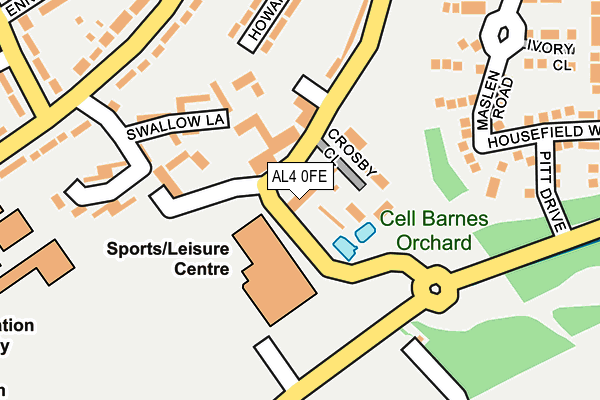
AL4 0FE is located in the Hill End electoral ward, within the local authority district of St Albans and the English Parliamentary constituency of St Albans. The Sub Integrated Care Board (ICB) Location is NHS Hertfordshire and West Essex ICB - 06N and the police force is Hertfordshire. This postcode has been in use since December 2001.


GetTheData
Source: OS OpenMap – Local (Ordnance Survey)
Source: OS VectorMap District (Ordnance Survey)
Licence: Open Government Licence (requires attribution)
| Easting | 517066 |
| Northing | 205881 |
| Latitude | 51.739417 |
| Longitude | -0.305975 |
GetTheData
Source: Open Postcode Geo
Licence: Open Government Licence
| Country | England |
| Postcode District | AL4 |
➜ See where AL4 is on a map ➜ Where is St Albans? | |
GetTheData
Source: Land Registry Price Paid Data
Licence: Open Government Licence
Elevation or altitude of AL4 0FE as distance above sea level:
| Metres | Feet | |
|---|---|---|
| Elevation | 90m | 295ft |
Elevation is measured from the approximate centre of the postcode, to the nearest point on an OS contour line from OS Terrain 50, which has contour spacing of ten vertical metres.
➜ How high above sea level am I? Find the elevation of your current position using your device's GPS.
GetTheData
Source: Open Postcode Elevation
Licence: Open Government Licence
| Ward | Hill End |
| Constituency | St Albans |
GetTheData
Source: ONS Postcode Database
Licence: Open Government Licence
| Frobisher Road (Drakes Drive) | Cell Barnes | 279m |
| Samuel Ryder Academy (Drakes Drive) | Cell Barnes | 324m |
| Samuel Ryder Academy (Drakes Drive) | Cell Barnes | 342m |
| Frobisher Road (Drakes Drive) | Cell Barnes | 380m |
| Ennerdale Close (Cell Barnes Lane) | Cell Barnes | 386m |
| St Albans City Station | 1.9km |
| St Albans Abbey Station | 2.6km |
| Park Street Station | 2.8km |
GetTheData
Source: NaPTAN
Licence: Open Government Licence
GetTheData
Source: ONS Postcode Database
Licence: Open Government Licence


➜ Get more ratings from the Food Standards Agency
GetTheData
Source: Food Standards Agency
Licence: FSA terms & conditions
| Last Collection | |||
|---|---|---|---|
| Location | Mon-Fri | Sat | Distance |
| The Camp P.o | 17:30 | 12:00 | 647m |
| Ashley Road St Albans L D O | 19:00 | 806m | |
| St Albans Delivery Office | 19:00 | 12:30 | 957m |
GetTheData
Source: Dracos
Licence: Creative Commons Attribution-ShareAlike
The below table lists the International Territorial Level (ITL) codes (formerly Nomenclature of Territorial Units for Statistics (NUTS) codes) and Local Administrative Units (LAU) codes for AL4 0FE:
| ITL 1 Code | Name |
|---|---|
| TLH | East |
| ITL 2 Code | Name |
| TLH2 | Bedfordshire and Hertfordshire |
| ITL 3 Code | Name |
| TLH23 | Hertfordshire CC |
| LAU 1 Code | Name |
| E07000240 | St Albans |
GetTheData
Source: ONS Postcode Directory
Licence: Open Government Licence
The below table lists the Census Output Area (OA), Lower Layer Super Output Area (LSOA), and Middle Layer Super Output Area (MSOA) for AL4 0FE:
| Code | Name | |
|---|---|---|
| OA | E00120247 | |
| LSOA | E01023678 | St Albans 015B |
| MSOA | E02004938 | St Albans 015 |
GetTheData
Source: ONS Postcode Directory
Licence: Open Government Licence
| AL4 0AA | Hill End Lane | 87m |
| AL4 0AB | Hill End Lane | 182m |
| AL1 5AL | Howard Close | 188m |
| AL4 0GT | Maslen Road | 200m |
| AL1 5AN | Howard Close | 205m |
| AL1 5AX | Mountbatten Close | 208m |
| AL4 0GS | Maslen Road | 212m |
| AL1 5AW | Drakes Drive | 217m |
| AL1 5AD | Drakes Drive | 254m |
| AL4 0GR | Pitt Drive | 256m |
GetTheData
Source: Open Postcode Geo; Land Registry Price Paid Data
Licence: Open Government Licence