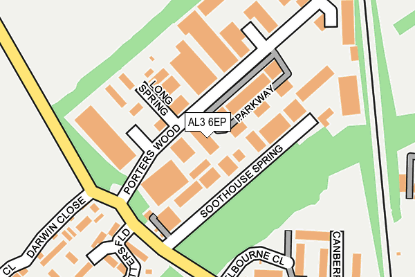
AL3 6EP is located in the Bernards Heath electoral ward, within the local authority district of St Albans and the English Parliamentary constituency of St Albans. The Sub Integrated Care Board (ICB) Location is NHS Hertfordshire and West Essex ICB - 06N and the police force is Hertfordshire. This postcode has been in use since April 2017.


GetTheData
Source: OS OpenMap – Local (Ordnance Survey)
Source: OS VectorMap District (Ordnance Survey)
Licence: Open Government Licence (requires attribution)
| Easting | 515603 |
| Northing | 209357 |
| Latitude | 51.770966 |
| Longitude | -0.325974 |
GetTheData
Source: Open Postcode Geo
Licence: Open Government Licence
| Country | England |
| Postcode District | AL3 |
➜ See where AL3 is on a map ➜ Where is St Albans? | |
GetTheData
Source: Land Registry Price Paid Data
Licence: Open Government Licence
| Ward | Bernards Heath |
| Constituency | St Albans |
GetTheData
Source: ONS Postcode Database
Licence: Open Government Licence
| Valley Road | St Albans | 387m |
| Firbank Road | St Albans | 393m |
| King William Iv Ph (Beech Road) | St Albans | 461m |
| St Albans Girls School (Girls School) | New Greens | 478m |
| Sandridge Gate Business Centre (St Albans Road) | St Albans | 510m |
| St Albans City Station | 2.3km |
| St Albans Abbey Station | 3.1km |
| Harpenden Station | 5.2km |
GetTheData
Source: NaPTAN
Licence: Open Government Licence
| Percentage of properties with Next Generation Access | 100.0% |
| Percentage of properties with Superfast Broadband | 100.0% |
| Percentage of properties with Ultrafast Broadband | 100.0% |
| Percentage of properties with Full Fibre Broadband | 0.0% |
Superfast Broadband is between 30Mbps and 300Mbps
Ultrafast Broadband is > 300Mbps
| Median download speed | 77.0Mbps |
| Average download speed | 67.2Mbps |
| Maximum download speed | 100.00Mbps |
| Median upload speed | 10.0Mbps |
| Average upload speed | 12.7Mbps |
| Maximum upload speed | 19.53Mbps |
| Percentage of properties unable to receive 2Mbps | 0.0% |
| Percentage of properties unable to receive 5Mbps | 0.0% |
| Percentage of properties unable to receive 10Mbps | 0.0% |
| Percentage of properties unable to receive 30Mbps | 0.0% |
GetTheData
Source: Ofcom
Licence: Ofcom Terms of Use (requires attribution)
GetTheData
Source: ONS Postcode Database
Licence: Open Government Licence


➜ Get more ratings from the Food Standards Agency
GetTheData
Source: Food Standards Agency
Licence: FSA terms & conditions
| Last Collection | |||
|---|---|---|---|
| Location | Mon-Fri | Sat | Distance |
| Porters Wood | 18:30 | 12:00 | 49m |
| Porterswood | 18:30 | 172m | |
| Beech Road P.o | 18:30 | 12:00 | 490m |
GetTheData
Source: Dracos
Licence: Creative Commons Attribution-ShareAlike
The below table lists the International Territorial Level (ITL) codes (formerly Nomenclature of Territorial Units for Statistics (NUTS) codes) and Local Administrative Units (LAU) codes for AL3 6EP:
| ITL 1 Code | Name |
|---|---|
| TLH | East |
| ITL 2 Code | Name |
| TLH2 | Bedfordshire and Hertfordshire |
| ITL 3 Code | Name |
| TLH23 | Hertfordshire CC |
| LAU 1 Code | Name |
| E07000240 | St Albans |
GetTheData
Source: ONS Postcode Directory
Licence: Open Government Licence
The below table lists the Census Output Area (OA), Lower Layer Super Output Area (LSOA), and Middle Layer Super Output Area (MSOA) for AL3 6EP:
| Code | Name | |
|---|---|---|
| OA | E00120420 | |
| LSOA | E01023713 | St Albans 007A |
| MSOA | E02004930 | St Albans 007 |
GetTheData
Source: ONS Postcode Directory
Licence: Open Government Licence
| AL3 6PQ | Porters Wood | 40m |
| AL3 6PF | Soothouse Spring | 62m |
| AL3 6PA | Parkway | 79m |
| AL3 6PD | Spring Valley Business Centre | 151m |
| AL3 6LY | Melbourne Close | 210m |
| AL3 6XT | The Caxton Centre | 215m |
| AL3 6NB | Valley Road | 219m |
| AL3 6LX | Melbourne Close | 220m |
| AL3 6LJ | Potters Field | 227m |
| AL3 6LU | Melbourne Close | 252m |
GetTheData
Source: Open Postcode Geo; Land Registry Price Paid Data
Licence: Open Government Licence