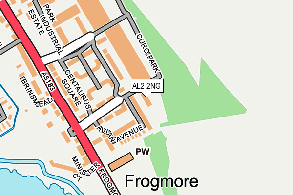
AL2 2NG is located in the Park Street electoral ward, within the local authority district of St Albans and the English Parliamentary constituency of St Albans. The Sub Integrated Care Board (ICB) Location is NHS Hertfordshire and West Essex ICB - 06N and the police force is Hertfordshire. This postcode has been in use since June 1996.


GetTheData
Source: OS OpenMap – Local (Ordnance Survey)
Source: OS VectorMap District (Ordnance Survey)
Licence: Open Government Licence (requires attribution)
| Easting | 515273 |
| Northing | 203513 |
| Latitude | 51.718507 |
| Longitude | -0.332713 |
GetTheData
Source: Open Postcode Geo
Licence: Open Government Licence
| Country | England |
| Postcode District | AL2 |
➜ See where AL2 is on a map ➜ Where is Frogmore? | |
GetTheData
Source: Land Registry Price Paid Data
Licence: Open Government Licence
Elevation or altitude of AL2 2NG as distance above sea level:
| Metres | Feet | |
|---|---|---|
| Elevation | 70m | 230ft |
Elevation is measured from the approximate centre of the postcode, to the nearest point on an OS contour line from OS Terrain 50, which has contour spacing of ten vertical metres.
➜ How high above sea level am I? Find the elevation of your current position using your device's GPS.
GetTheData
Source: Open Postcode Elevation
Licence: Open Government Licence
| Ward | Park Street |
| Constituency | St Albans |
GetTheData
Source: ONS Postcode Database
Licence: Open Government Licence
| Minster Court (Frogmore) | Frogmore | 160m |
| Minster Court (Frogmore) | Frogmore | 164m |
| Curo Park (Frogmore) | Frogmore | 279m |
| Curo Park (Frogmore) | Frogmore | 346m |
| Hyde Lane (Radlett Road) | Frogmore | 517m |
| How Wood (Herts) Station | 0.8km |
| Park Street Station | 0.9km |
| Bricket Wood Station | 2.3km |
GetTheData
Source: NaPTAN
Licence: Open Government Licence
GetTheData
Source: ONS Postcode Database
Licence: Open Government Licence


➜ Get more ratings from the Food Standards Agency
GetTheData
Source: Food Standards Agency
Licence: FSA terms & conditions
| Last Collection | |||
|---|---|---|---|
| Location | Mon-Fri | Sat | Distance |
| Orchard Drive | 17:30 | 12:00 | 1,078m |
| Mount Drive | 17:30 | 12:00 | 1,147m |
| How Wood P.o | 18:30 | 12:00 | 1,242m |
GetTheData
Source: Dracos
Licence: Creative Commons Attribution-ShareAlike
The below table lists the International Territorial Level (ITL) codes (formerly Nomenclature of Territorial Units for Statistics (NUTS) codes) and Local Administrative Units (LAU) codes for AL2 2NG:
| ITL 1 Code | Name |
|---|---|
| TLH | East |
| ITL 2 Code | Name |
| TLH2 | Bedfordshire and Hertfordshire |
| ITL 3 Code | Name |
| TLH23 | Hertfordshire CC |
| LAU 1 Code | Name |
| E07000240 | St Albans |
GetTheData
Source: ONS Postcode Directory
Licence: Open Government Licence
The below table lists the Census Output Area (OA), Lower Layer Super Output Area (LSOA), and Middle Layer Super Output Area (MSOA) for AL2 2NG:
| Code | Name | |
|---|---|---|
| OA | E00169675 | |
| LSOA | E01023720 | St Albans 019C |
| MSOA | E02004942 | St Albans 019 |
GetTheData
Source: ONS Postcode Directory
Licence: Open Government Licence
| AL2 2FE | Avian Avenue | 44m |
| AL2 2FG | Avian Avenue | 71m |
| AL2 2FD | Curo Park | 97m |
| AL2 2FF | Avian Avenue | 121m |
| AL2 2FH | Centaurus Square | 123m |
| AL2 2DD | Curo Park | 148m |
| AL2 2FB | Frogmore | 161m |
| AL2 2LH | Frogmore | 180m |
| AL2 2LQ | Moorlands | 188m |
| AL2 2EW | Water Meadows | 209m |
GetTheData
Source: Open Postcode Geo; Land Registry Price Paid Data
Licence: Open Government Licence