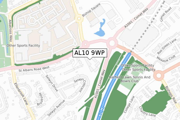
AL10 9WP is located in the Hatfield Villages electoral ward, within the local authority district of Welwyn Hatfield and the English Parliamentary constituency of Welwyn Hatfield. The Sub Integrated Care Board (ICB) Location is NHS Hertfordshire and West Essex ICB - 06K and the police force is Hertfordshire. This postcode has been in use since August 2019.


GetTheData
Source: OS Open Zoomstack (Ordnance Survey)
Licence: Open Government Licence (requires attribution)
Attribution: Contains OS data © Crown copyright and database right 2024
Source: Open Postcode Geo
Licence: Open Government Licence (requires attribution)
Attribution: Contains OS data © Crown copyright and database right 2024; Contains Royal Mail data © Royal Mail copyright and database right 2024; Source: Office for National Statistics licensed under the Open Government Licence v.3.0
| Easting | 521249 |
| Northing | 208270 |
| Latitude | 51.760004 |
| Longitude | -0.244568 |
GetTheData
Source: Open Postcode Geo
Licence: Open Government Licence
| Country | England |
| Postcode District | AL10 |
➜ See where AL10 is on a map ➜ Where is Hatfield? | |
GetTheData
Source: Land Registry Price Paid Data
Licence: Open Government Licence
| Ward | Hatfield Villages |
| Constituency | Welwyn Hatfield |
GetTheData
Source: ONS Postcode Database
Licence: Open Government Licence
| The Comet Hotel (St Albans Road) | Hatfield | 76m |
| The Comet Hotel (St Albans Road) | Hatfield | 104m |
| The Galleria (Cavendish Way) | Hatfield | 239m |
| The Galleria (Cavendish Way) | Hatfield | 267m |
| The Galleria (Cavendish Way) | Hatfield | 293m |
| Hatfield (Herts) Station | 2km |
| Welham Green Station | 3.5km |
| Brookmans Park Station | 5.1km |
GetTheData
Source: NaPTAN
Licence: Open Government Licence
GetTheData
Source: ONS Postcode Database
Licence: Open Government Licence


➜ Get more ratings from the Food Standards Agency
GetTheData
Source: Food Standards Agency
Licence: FSA terms & conditions
| Last Collection | |||
|---|---|---|---|
| Location | Mon-Fri | Sat | Distance |
| The Galleria | 18:30 | 12:00 | 253m |
| College Lane | 17:00 | 12:00 | 365m |
| Ellenbrook Lane | 17:00 | 12:00 | 473m |
GetTheData
Source: Dracos
Licence: Creative Commons Attribution-ShareAlike
The below table lists the International Territorial Level (ITL) codes (formerly Nomenclature of Territorial Units for Statistics (NUTS) codes) and Local Administrative Units (LAU) codes for AL10 9WP:
| ITL 1 Code | Name |
|---|---|
| TLH | East |
| ITL 2 Code | Name |
| TLH2 | Bedfordshire and Hertfordshire |
| ITL 3 Code | Name |
| TLH23 | Hertfordshire CC |
| LAU 1 Code | Name |
| E07000241 | Welwyn Hatfield |
GetTheData
Source: ONS Postcode Directory
Licence: Open Government Licence
The below table lists the Census Output Area (OA), Lower Layer Super Output Area (LSOA), and Middle Layer Super Output Area (MSOA) for AL10 9WP:
| Code | Name | |
|---|---|---|
| OA | E00121549 | |
| LSOA | E01023938 | Welwyn Hatfield 010D |
| MSOA | E02004989 | Welwyn Hatfield 010 |
GetTheData
Source: ONS Postcode Directory
Licence: Open Government Licence
| AL10 9SQ | Ashbury Close | 103m |
| AL10 9NL | Selwyn Crescent | 146m |
| AL10 9RJ | St Albans Road West | 204m |
| AL10 9NN | Selwyn Crescent | 208m |
| AL10 9NW | Selwyn Crescent | 235m |
| AL10 9NH | Selwyn Drive | 249m |
| AL10 9NJ | Selwyn Drive | 283m |
| AL10 9SU | Crossbrook | 358m |
| AL10 9SR | The Sidings | 363m |
| AL10 9PQ | College Lane | 369m |
GetTheData
Source: Open Postcode Geo; Land Registry Price Paid Data
Licence: Open Government Licence